When you’re flying on a commercial airplane, you may wonder how the pilots know where to go. Believe it or not, today’s airplanes rely on some pretty nifty technology to navigate from point A to point B. Let’s take a look at the main systems that help guide aircraft along their journey.
GPS
One of the most important navigation tools is the Global Positioning System, also known as GPS. GPS satellites orbiting high above the Earth send signals that allow the airplane’s computers to pinpoint the aircraft’s location. GPS offers amazing accuracy – it can locate an airplane within just a couple football fields! This allows pilots to follow the planned route very precisely. Even if the GPS fails, the airplane has backup systems to maintain safe navigation.
Inertial Reference System (IRS)
Inside each aircraft is a system called the Inertial Reference System (IRS). The IRS uses motion sensors to detect how the airplane is accelerating and moving along all three axes – pitch, roll and yaw. Before takeoff, the pilots program the starting location into the IRS computer. As the airplane moves, the IRS senses these motions and calculates where the aircraft is headed. While not as perfect as GPS, IRS provides a reliable backup when other navigation references aren’t available.
Radar
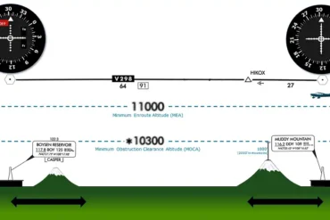
Here on the ground, radio beacons transmit signals up to passing aircraft. The airplane’s computers use these radio beams to determine the plane’s range and direction from each beacon. By receiving multiple signals, the navigation systems can pinpoint the airplane’s location very accurately. More radio beacons equals better precision!
Modern aviation relies on some amazing technologies to direct aircraft along their intended route. GPS, motion sensors, and radio beacons work together to provide pilots with the information they need for safe, efficient navigation. Pretty cool how it all comes together, isn’t it?
