Controlled flight into terrain (CFIT) incidents, once a grave concern, have markedly declined over the years, thanks to the implementation of Terrain Awareness and Warning Systems (TAWS). These cutting-edge systems provide crucial information, acting as a protective shield for aircraft navigating diverse terrains under varying weather conditions.
How TAWS Works:
- Data Fusion: TAWS integrates data from multiple sources, including GPS, aircraft position, speed, and direction. It then compares this information with an extensive database containing Earth’s topography and man-made obstacles.
- Precision Database: The database, meticulously crafted from radar topography imagery (captured by the U.S. space shuttle program), DOD data, and other sources, ensures high accuracy. When overlaid with real-time aircraft position, TAWS issues alerts to prevent CFIT.
- Alert Categories:
- TAWS-A: Mandatory for large aircraft like airliners.
- TAWS-B: Required for Part 91 and 135 turbine aircraft with at least six passenger seats.
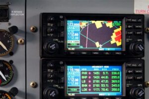
- Terrain Map: An essential component.
Inventor and Impact:
Retired Honeywell engineer Don Bateman deserves credit for TAWS. His groundwork, which began with the ground proximity warning system in the 1970s, laid the foundation for Honeywell’s Enhanced GPWS. Remarkably, CFIT accidents among U.S. airlines have plummeted from a leading cause of fatalities to zero.
Key TAWS Warnings:
- High Sink Rate Alerts: Issued regardless of terrain conditions.
- Terrain Proximity Alerts: Rapidly diminishing separation from terrain.
- Configuration Alerts: Incorrect landing gear or flap settings.
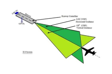
- Glideslope Deviation Alerts: Preventing excessive descent.
- Altitude Loss Warnings: Post-takeoff altitude deviations.
- Bank Angle Callouts: Monitoring excessive banking.
In summary, TAWS exemplifies the marriage of technology and safety, safeguarding lives aloft while maintaining clarity and accessibility for pilots and passengers alike.
