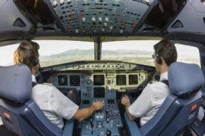
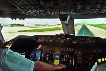
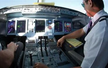
Navigating an aircraft from takeoff to landing is a multifaceted process demanding skill, knowledge, and adept use of navigational tools. Pilots seamlessly blend traditional and modern aids to ensure safe, timely arrivals. In this exploration, we delve into pilot navigation techniques, the significance of aviation navigation, available navigational aids, and the impact of efficient tools.
Navigating the Skies:
Pilots deftly wield a hybrid arsenal of navigational tools. Traditionally, maps, compasses, and visual cues guided their flight paths. Today, cutting-edge technology enhances their precision. Sophisticated aids like GPS, inertial navigation systems, and flight management systems empower pilots to chart accurate courses.
Determining an aircraft’s position and direction relative to the ground is paramount. Pilots rely on altimeters, airspeed indicators, and vertical speed indicators. These instruments furnish vital data on altitude, speed, and course, enabling informed decisions.
Aviation’s Navigational Toolbox:
Navigational tools span a spectrum, from time-honored maps and compasses to modern marvels like GPS and inertial systems. These instruments empower pilots, ensuring smooth journeys through the skies.
GPS, ubiquitous in modern aviation, empowers pilots with precise location tracking and progress monitoring. Meanwhile, inertial navigation systems—relying on gyroscopes and accelerometers—pinpoint an aircraft’s position.
Flight management systems, equally pivotal, allow pilots to input flight plans into computers. These systems optimize fuel-efficient routes, providing real-time weather updates and airspace restrictions.
The Crucial Role of Navigation
Navigation lies at aviation’s core. It ensures safe, timely arrivals and aids air traffic control. Without effective navigation, flights would falter, and airspace management would crumble.
In emergencies, navigation becomes a lifeline. Pilots swiftly navigate to safety, relying on efficient tools to make split-second decisions.
Types of Navigational Aids
Aviation boasts diverse navigational aids:
- Visual Aids: Landmarks, beacons, and lights guide pilots.
- Radio-Based Aids: VOR (VHF omnidirectional range) and NDB (non-directional beacon) systems use radio signals to determine position and direction.
- Satellite-Based Aids: notably GPS, ascend in aviation’s hierarchy. Pilots leverage GPS for precise location tracking, vital flight path insights, and altitude-speed synchronization.
Types of Navigational Routes
Pilots select routes meticulously, ensuring safe, efficient journeys. Here are the key types:
1. VOR Navigation
VOR (VHF omnidirectional range) guides pilots from one station to another via radio signals. Position relative to the VOR station becomes clear.
2. GPS Navigation
GPS (Global Positioning System)—a satellite-based marvel—provides pilots worldwide with accurate position data, a beacon for seamless navigation.
3. RNAV Navigation
RNAV (Area Navigation) empowers pilots to chart custom flight paths within ground-based or satellite-based coverage areas.
4. DME Navigation
DME (Distance Measuring Equipment) gauges distance between aircraft and ground-based DME stations via radio signals.
5. Area Navigation (RNAV)
RNAV, synonymous with efficiency, allows direct routing, saving time, fuel, and easing airspace congestion.
6. Required Navigation Performance (RNP)
RNP (Required Navigation Performance)—a beacon of precision—guides aircraft along meticulously defined paths. Advanced onboard systems enhance safety, reduce separation requirements, and optimize airspace utilization.
In-Flight Navigation Insights
Mid-flight, pilots orchestrate a symphony of instruments and systems. GPS, Inertial Navigation Systems (INS), and VOR/DME provide real-time data on position, heading, altitude, and speed. Armed with this knowledge, pilots chart their course, ensuring safe arrivals.
Navigational Challenges
- Weather Whirlwinds: Turbulence, thunderstorms, and low visibility test pilots.
- Mechanical Mysteries: Aircraft system glitches or instrument hiccups.
- Airspace Jigsaw: Congested skies demand finesse.
Precision Landing: Guided by ILS
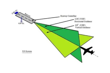
During descent, pilots rely on the Instrument Landing System (ILS). Its components—the localizer, glide slope, and marker beacons—paint a precise picture of the descent path and runway alignment.
Landing Challenges
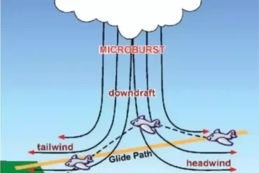
- Weather Woes: Crosswinds, gusts, and limited visibility challenge pilots.
- Mechanical Quandaries: Landing gear or brake issues add complexity.
- Runway Realities: Obstructions and incursions loom.
- Human Hurdles: Errors or misjudgments.
Approaching the Runway
Three landing approaches unfold:
- Visual Approach: Pilots trust their eyes, aligning with the runway visually.
- Instrument Approach: Instruments guide the aircraft safely to the runway.
- Precision Approach: Advanced systems ensure pinpoint glide path alignment, culminating in a precise landing.
Navigational Tools’ Impact in Aviation
Efficient navigational tools are the backbone of aviation, ensuring safe and streamlined flights. By minimizing accidents and delays, these tools enhance both passenger safety and operational efficiency. Additionally, they empower air traffic controllers to manage airspace flow, mitigating congestion and bolstering safety protocols.
But their impact extends beyond the cockpit. Environmentally conscious, these tools reduce fuel consumption and emissions. By enabling fuel-efficient routes, they contribute to a greener industry.
Conclusion
Navigating an aircraft—from takeoff to landing—demands skill, knowledge, and adept tool usage. Pilots seamlessly blend tradition and technology, ensuring timely, secure arrivals. The significance of navigation reverberates throughout aviation, impacting safety, efficiency, and our planet.
