
Overview of Omega
Omega was an innovative navigation system that offered long-range Very Low Frequency (VLF) coverage globally. Launched in the early 1970s, it operated until 1997, providing reliable navigation for maritime and aerial activities. The system worked by generating hyperbolic lines of position through precise phase difference measurements from VLF signals transmitted by widely spaced antennas.
How Omega Operated
The Omega system consisted of eight transmitting stations, strategically located around the world, broadcasting VLF signals between 10 and 14 kilohertz (kHz). It aimed to assist in navigation with medium accuracy, typically within two to four nautical miles. Each station’s signals were utilized by Omega receivers to pinpoint locations using phase comparisons from multiple stations, creating intersecting lines of position.
Key Components
Omega’s functionality relied on three main components: the transmitting system, the signals in the Earth-Ionosphere medium, and the navigation computers. Each element played a crucial role in ensuring the system’s overall performance. The transmitting system included eight stations, identified from A to H, positioned globally. These stations featured complex timing equipment, VLF transmitters, and specially designed antennas, which were essential for effective signal transmission.
Transmitting Stations
The eight Omega stations were:
-
A: Bratland, Norway
-
B: Paynesville, Liberia
-
C: Kaneoke, Hawaii, USA
-
D: Lamoure, North Dakota, USA
-
E: Plaine Chabrier, La Reunion
-
F: Golfo Nuevo, Chalut, Argentina
-
G: Woodside, Victoria, Australia
-
H: Shushi-Wan, Tsushima Island, Japan
Each station utilized large antennas that required synchronization to operate as a cohesive system. While ideally, all signals would come from a single frequency source, practical constraints led to the use of atomic clocks for accurate synchronization across stations.
Signal Transmission and Propagation
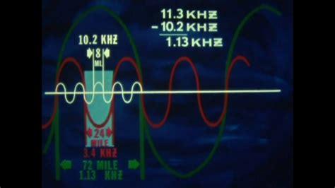
Each station transmitted four common frequencies: 10.2 kHz, 11.05 kHz, 11 1/3 kHz, and 13.6 kHz, along with unique frequencies for station identification. Signals were transmitted in a sequence that ensured no overlap, allowing receivers to track them effectively. The signals traveled vast distances but were affected by various factors that necessitated propagation corrections to ensure accurate positioning.
Navigation Equipment
Typical Omega user equipment included an antenna, receiver, and navigation computer. The receiver tracked signals, identified the transmitting stations, and measured the phase relative to a local reference. With known station locations, the navigation computer used multilateration to calculate the user’s latitude and longitude. By measuring the phase of signals within defined lanes, the system could accurately determine position using direct ranging or hyperbolic calculations.
Conclusion
By the time Omega was decommissioned in 1997, technological advancements had transformed navigation processes. Digital navigation computers automated the position determination, enhancing accuracy and efficiency in maritime and aerial navigation.