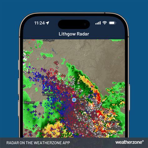
A big and powerful weather system is currently strengthening over New South Wales (NSW), with officials alerting residents to expect deteriorating severe conditions within the next 24 hours. This extensive weather system, spanning from the Mid North Coast to the South Coast, has already unleashed heavy rainfalls and gusty winds, with the most intense storm conditions anticipated from Tuesday afternoon through Wednesday morning.
The Emergency Services Minister, Jihad Dib, characterized this weather event as “enormous” due to its vast scale and potential impact. In the last 24 hours alone, the State Emergency Service (SES) has responded to over 600 emergency calls related to the severe weather. Reports indicate that some areas, including Jervis Bay, have recorded over 120 millimeters of rainfall, while other parts of the state have seen between 50 to 90 millimeters. The situation is expected to worsen significantly, with increasing rainfall and intensifying winds on the horizon.
Minister Dib warned, “Now that might seem pretty bad, but the terrible thing is that the situation is going to worsen over the course of the next 24 hours.” The most severe conditions are predicted for late Tuesday afternoon and evening, with a potential East Coast Low forming as multiple low-pressure systems converge. This convergence could lead to even more hazardous weather patterns.
SES on High Alert: Volunteers Ready for Action
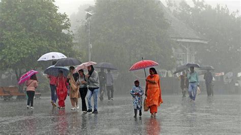
In response to the escalating situation, the NSW SES has been placed on high alert, with approximately 1,200 volunteers standing by to assist in any emergencies. As of 1:45 PM on Tuesday, two “Watch and Act” alerts and 14 “Advice” warnings have been issued, specifically regarding flooding and severe weather conditions along the NSW coastline. Residents in affected areas have been urged to avoid unnecessary travel and to refrain from driving through floodwaters, which can be deceptively dangerous.
“We know the grounds are saturated, and the winds could reach speeds of 125 kilometers per hour, causing trees to be uprooted and loose objects to become dangerous projectiles,” cautioned Minister Dib. Chief Superintendent Andrew Cribb of the SES confirmed that wind gusts are likely to peak on Tuesday evening and continue into Wednesday, particularly affecting regions such as the Hunter, Mid North Coast, Central Coast, and southern NSW.
Flooding and Flash Flooding Expected Across the State
In addition to the fierce winds, heavy rains are anticipated to exacerbate flooding conditions, especially in the Hunter region and along the Mid North Coast. Flash flooding poses a significant threat, with saturated grounds leading to road closures in susceptible areas. The SES is actively monitoring the situation, preparing for up to 100 mm of additional rainfall statewide, with isolated pockets potentially receiving as much as 250 mm in certain regions.
Minister Dib noted the intensity of this weather system, stating, “This system is much more intense and much sharper than the prolonged flooding NSW saw in May.” The combination of heavy rainfall and strong winds could lead to further complications, especially given that many trees have already been weakened by previous storms and heavy rains.
Community Preparedness and Ongoing Monitoring
As the weather system advances inland, the NSW government is urging residents to stay informed and take appropriate precautions. The SES emphasizes the importance of checking local weather warnings and utilizing the “Hazards Near Me” app for real-time updates. For those living in flood-prone areas, it is crucial to take proactive steps, particularly if they have previously experienced flooding.
Emergency services have been conducting door-to-door checks in vulnerable neighborhoods, encouraging locals to heed their guidance and remain vigilant. Minister Dib expressed empathy for the communities affected, stating, “We’ve been here before, and I can fully understand how hard this is for our communities. It’s been a tough few months, but with the hard work of our volunteers, we will get through this.”
Impact on Coastal and Inland Regions
The repercussions of the storm have already been felt across numerous parts of NSW, with the heaviest rainfall concentrated in locations such as Jervis Bay, Taree, and the Blue Mountains. Winds have picked up intensity across the Hunter and Central Coast regions, with expectations of further significant rainfall in the coming hours, particularly for the lower Mid North Coast and southern regions of the state.
For individuals residing in these affected areas, it is vital to stay indoors, secure any loose items outside, and avoid driving during severe weather conditions. Minister Dib cautioned, “Even if you see blue skies, don’t be fooled. The danger is not over, and we need to remain prepared for sudden changes in the weather.”
Conclusion: Staying Safe During Severe Weather
As a large and formidable weather system continues to loom over NSW, citizens are reminded to prepare and stay updated with the latest weather warnings. With expectations that the storm will intensify in the next 24 hours, both emergency and volunteer services are working tirelessly to mitigate the risks associated with heavy rain, flooding, and high winds. Local officials are closely monitoring the situation, and residents in susceptible zones must follow evacuation instructions and heed emergency warnings from the SES. The state administration and SES are implementing comprehensive measures to ensure public safety, with extensive preparations in place to cope with the adverse weather conditions.


