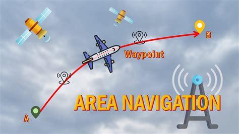
Precision-Area Navigation (P-RNAV) is an important step in the evolution of air navigation in Europe. It follows Basic RNAV, which became mandatory in European airspace back in April 1998. P-RNAV provides a high level of accuracy, allowing for a cross-track accuracy of RNP1 (+/- 1NM). The aircraft’s P-RNAV equipment automatically calculates its desired flight path using a series of waypoints stored in a database.
Designed specifically for RNAV-equipped aircraft, P-RNAV procedures follow a common set of design principles. This helps replace the many existing RNAV procedures, many of which aren’t suitable for all aircraft types. Variations in RNAV approval requirements, procedure design, and navigation data integrity could impact safety, making this standardization crucial. P-RNAV enhances RNAV functionality across all flight phases, except during final approaches and missed approaches. This means routes can be defined to better serve both aircraft operators and air navigation service providers, often leading to shorter, more direct paths that connect seamlessly with en-route structures.
Additionally, environmental concerns can influence route design, allowing for optimal use of available airspace while avoiding densely populated areas. Thoughtful design can also lead to separated arrival and departure streams, minimizing the need for radar vectors. This reduction can lower workload for pilots and controllers alike, creating a clearer understanding of the anticipated tactical route and remaining distance. P-RNAV is expected to improve safety significantly by introducing standardized approach procedures, promoting predictable flight paths, and ensuring both pilots and controllers share knowledge about intended routes.
The distinction between B-RNAV and P-RNAV is essential to understand. Basic Area Navigation (B-RNAV) was the precursor to RNAV in Europe, aiming to enhance en-route capacity with minimal aircraft requirements. It demands a track-keeping accuracy of +/-5 NM for at least 95% of the flight time, achievable with various navigation technologies like DME/DME, GPS, or VOR/DME.
Looking ahead, while there isn’t a mandate for P-RNAV in the ECAC area, European states are gradually implementing these requirements for terminal RNAV procedures. These will be consistent across different countries, based on shared design and operational principles to maintain safety. Since November 2005, aircraft using RNAV terminal procedures in major ECAC airspaces have faced specific requirements for P-RNAV approval. In cases where route segments fall below minimum flight altitudes, P-RNAV certification is necessary. For other segments, B-RNAV may suffice, unless otherwise stated. As of 2008, the U.S. terminal airspace application previously known as US RNAV Type B has been rebranded as RNAV 1, aligning it with the Performance-Based Navigation (PBN) concept.
P-RNAV approval requirements are outlined in JAA TGL-10, and to clarify any questions, EUROCONTROL and JAA have developed guidance for P-RNAV approvals. Most modern aircraft can meet the standards set by TGL-10, but operators must ensure proper pilot training, review Standard Operating Procedures (SOPs), and possibly update aircraft Minimum Equipment Lists (MELs) to include P-RNAV features.
The future of navigation includes RNP-RNAV, which represents the final step towards a comprehensive area navigation system. This system will support all flight phases with precise track-keeping accuracy aligned with prescribed RNP values. However, no mandates for RNP-RNAV are expected before 2015.
Finally, ICAO’s Performance-Based Navigation (PBN) Concept replaces earlier RNP frameworks. While RNP is still mentioned within PBN, it now only refers to specifications requiring onboard performance monitoring. The PBN framework consists of three parts: the Navigation Specification, the Navaid Infrastructure, and the Navigation Application. The Navigation Specification details performance requirements such as accuracy and continuity for operations in specific airspaces, including necessary navigation functionalities. The Navaid Infrastructure involves ground or space-based navigation aids defined in each Navigation Specification. Lastly, the Navigation Application pertains to how these specifications and infrastructures are utilized in airspace management and instrument flight procedures.

 Approach: Enhancing Aviation Precision and Safety")

")
")
")
")

")