Electronic Terrain and Obstacle Data, or eTOD, represents the digital mapping of terrain and obstacles tailored to meet various user needs. This includes applications like the Enhanced Ground Proximity Warning System (EGPWS), Terrain Awareness and Warning Systems (TAWS), and more.
A terrain dataset essentially captures the elevation of the Earth’s surface at specific points. Key characteristics of a terrain database include the layout of these points, as well as the horizontal and vertical reference systems used for measurement. In the context of eTOD, terrain refers to the Earth’s surface featuring natural elements like mountains, hills, valleys, lakes, and permanent ice, while excluding man-made obstacles.
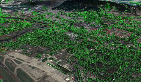
On the other hand, an obstacle database illustrates both natural and artificial structures that could pose a risk to air navigation. According to eTOD definitions, obstacles encompass all fixed and mobile objects that either interfere with aircraft movement on the ground or extend into airspace meant to keep aircraft safe in flight.
States have a responsibility to provide electronic terrain and obstacle data in line with strict numerical standards across four designated areas of their territory. These areas are as follows:
-
Area 1: Covers the entire state territory.
-
Area 2: Represents the terminal control area, which is either the whole area or a 45-kilometer radius, divided into four sections.
-
Area 3: Includes the aerodrome or heliport area, extending from the runway edges to 90 meters from the centerline, and 50 meters from the edges of other movement zones.
-
Area 4: Pertains to Category II or III operation areas, focused on runways for precision approaches, extending 60 meters on either side of the centerline and 900 meters from the runway threshold along the centerline.
")
")
 Works")


