Airspace in the United States is categorized into controlled and uncontrolled sectors. Controlled airspace includes Class B, C, D, and E, where ATC (Air Traffic Control) services are actively managing air traffic. If your drone flight enters any of these zones, you must obtain prior authorization from the FAA. On the other hand, Class G is considered uncontrolled and does not require authorization for drone operations.
Understanding which class you are operating in is fundamental, as approximately 30–40% of FAA test questions relate to reading airspace charts, understanding class boundaries, and determining whether authorization is required.
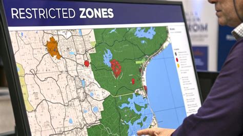
Decoding Sectional Aeronautical Charts (SACs)
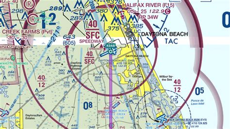
The Sectional Aeronautical Chart is the FAA’s official map for aviators. Updated biannually, it illustrates:
- Terrain elevations
- Controlled and uncontrolled airspace boundaries
- Airport locations and frequencies
- Latitude and longitude grid lines
When viewing a chart, controlled airspace is depicted using various line styles:
- Solid blue lines for Class B
- Solid magenta lines for Class C
- Dashed blue lines for Class D
- Dashed magenta lines for Class E (surface-level)
A typical example is the Nashville Class C airspace (BNA), which appears as a solid magenta circle and extends from the surface to 4,600 feet MSL. Knowing how to interpret these symbols is crucial to identifying whether a planned drone flight requires FAA approval.
Tools for Researching Airspace Requirements
To simplify the chart analysis process, numerous digital tools and mobile applications are available:
- VFRMap and SkyVector provide free access to digitized FAA Sectional Charts.
- Aloft (formerly Kittyhawk) offers address-based queries and airspace overlays, helping you visualize whether your planned operation falls into controlled zones.
These tools are invaluable not only for planning but also for understanding airspace rules during your FAA exam.
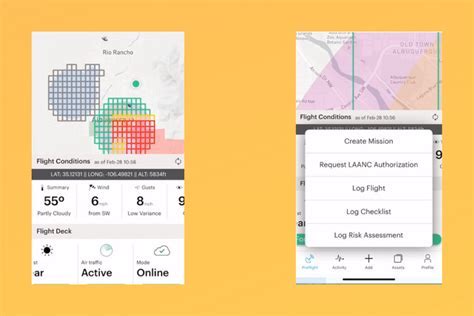
Using LAANC for Instant Airspace Authorization
For faster access to controlled airspace, drone pilots can use the Low Altitude Authorization and Notification Capability (LAANC) system. This automated system enables near-instant airspace approval at over 400 ATC facilities and 600 U.S. airports, in partnership with companies like Skyward, Kittyhawk, and DJI.
To request via LAANC:
- Open your chosen LAANC-enabled app.
- Input the mission details—location, date, time, and altitude.
- Submit the authorization request.
If your request falls within pre-approved parameters (e.g., below a defined grid ceiling altitude), LAANC can issue authorization almost immediately. This capability has dramatically reduced turnaround times and allowed for more agile commercial drone operations.
When LAANC Isn’t Available: FAADroneZone Manual Requests
In some cases, LAANC may not be available—such as near smaller airports or non-participating ATC jurisdictions. In these situations, the fallback is to use the FAADroneZone portal to manually submit an Airspace Authorization request.
Steps to follow:
- Create an account at faadronezone.faa.gov.
- Navigate to the Part 107 Dashboard.
- Choose Waivers & Authorizations → Create Part 107 Waiver/Authorization → Airspace Authorization.
- Complete the following sections:
- Acknowledgement: Provide a title such as “Ongoing Roof Inspections in BNA Class C Airspace”. Specify the Responsible Party.
- Operational Parameters: Specify date range (within 24 months), location (use latitude/longitude in DMS format), and select whether this is a Blanket Area or Wide Area request.
- Description & Justification: While not mandatory, we recommend including detailed descriptions of the operation and safety mitigations (e.g., use of Visual Observers, altitude restrictions, NOTAM issuance).
- Review & Submit: Submit the request and note the reference number. Approval times range from a few weeks to up to 90 days.
Example narrative:
“We intend to obtain site photographs and video footage of ongoing construction projects. The UAS will be limited to an altitude of 200 feet AGL. A two-person crew will be deployed, comprising a Remote Pilot in Command (PIC) and a Visual Observer (VO). A NOTAM will be issued 24 hours prior to each flight session.”
Distinguishing Authorization from Waivers
A frequent point of confusion arises between Airspace Authorizations, Airspace Waivers, and Part 107 Waivers.
- Airspace Authorization: This is an approval from ATC to operate in controlled airspace. It is mission-specific or region-specific and typically granted for short-term operations.
- Airspace Waiver: This is a broader exemption under 14 CFR 107.41, where operations require justification of equivalent safety. Use this if your mission parameters exceed LAANC thresholds or involve complex risk elements.
- Part 107 Waiver (Non-Airspace): Applies to rules such as flying beyond visual line of sight (BVLOS), operating at night without lighting, or flying over people. These are submitted via a different form and involve a rigorous safety case.
Each serves a distinct regulatory purpose. If your operation requires multiple exceptions, the correct workflow is to first obtain your Part 107 Non-Airspace Waiver, then pursue airspace permissions.
Combined Requests and Application Workflow
While the FAA has streamlined the process, it does not permit combined waiver + authorization submissions in a single form. You must:
- Apply for your Part 107 waiver separately.
- Once granted, apply for your Airspace Authorization and reference your waiver.
- Prepare for potentially longer wait times, particularly for high-risk operations.
Understanding this workflow ensures you are not delayed by administrative setbacks.
The ATC Myth: Why You Can’t Call the Tower Directly
One of the most persistent myths in the drone community is that you can “just call the tower” to obtain authorization. This is incorrect and against FAA policy. The FAA requires that all authorization requests be made via LAANC or the FAADroneZone portal. Any attempt to bypass these channels is considered non-compliant and may subject you to enforcement actions.
ATC personnel are not authorized to grant UAS permissions directly and will typically redirect your inquiry. Respecting these protocols ensures consistency and safety across the NAS (National Airspace System).
Conclusion: Preparation and Precision Lead to Approval
Securing FAA airspace authorization demands a combination of technical literacy, regulatory knowledge, and precise documentation. Whether you are a student preparing for the Part 107 test or a commercial operator planning a complex mission, understanding your airspace, using the right tools, and following the correct workflows are essential.
We strongly recommend that operators:
- Familiarize themselves with Sectional Charts and LAANC map ceilings.
- Use tools like Aloft and SkyVector for real-time research.
- Begin the FAADroneZone request process early, especially for non-LAANC areas.
- Document operations with clarity, include safety protocols, and maintain contact logs.
By mastering these steps, you not only ensure compliance but also enhance your professional credibility as a drone operator in the growing landscape of UAS aviation.