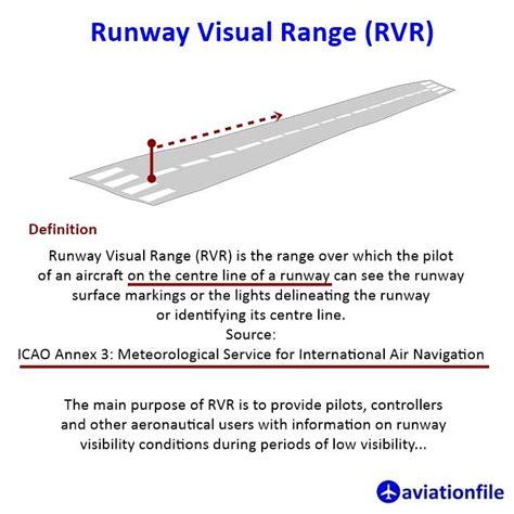
Runway Visual Range (RVR) refers to how far a pilot can see the runway markings or lights while aligned with the center of the runway. This measurement helps pilots determine visibility conditions, especially when visibility is low due to factors like fog, rain, or dust storms. RVR is not just a simple observation; it’s based on calculations that consider various elements. These include atmospheric factors, like how much light is scattered in the air, as well as physical factors, such as the brightness needed for visibility. Operational factors, like the intensity of runway lights, also play a role.
The main goal of RVR is to give pilots and air traffic controllers critical information about runway conditions. This is especially important during takeoff and landing, where visibility is crucial. RVR values are considered more reliable than standard visibility reports. When the RVR is below certain minimums, it may not be safe to approach the runway, particularly for precision landings.
RVR values are provided when visibility drops below 1500 meters. Depending on the category of operations, RVR can represent different parts of the runway. For non-precision approaches or Category I operations, it applies to the touchdown zone. For Category II operations, it covers both the touchdown zone and the mid-point. Finally, for Category III operations, it includes the touchdown zone, mid-point, and stop-end.
You can find RVR information in local routine reports, special reports, and weather data like METAR and SPECI.
 Works")


")

")

")
")