Air travel depends on extraordinary precision, and one of the most important yet overlooked details is the unit used to measure distance. While most people think in terms of miles or kilometers, pilots, air traffic controllers, and flight management systems rely on nautical miles. This standard has remained unchanged for decades because it aligns perfectly with the way the Earth is mapped, making long-distance navigation safer, more efficient, and universally consistent.
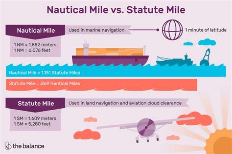
Unlike a statute mile, which measures 5,280 feet, a nautical mile is defined as exactly 1,852 meters, or approximately 1.151 statute miles. Although the name includes the word “mile,” the international definition is based entirely on the metric system. This unique measurement directly corresponds to the Earth’s geometry, allowing pilots to navigate accurately across continents and oceans without introducing unnecessary mathematical conversions.
The reason airplanes use nautical miles begins with latitude and longitude. The Earth is divided into a global grid of coordinates, and one nautical mile closely represents one minute of latitude. Because these coordinates already describe positions on the Earth’s curved surface, measuring distance in nautical miles creates a seamless relationship between maps, navigation charts, and flight computers. This elegant connection greatly reduces complexity during flight planning and en-route navigation.
Why Nautical Miles Match the Earth’s Curvature
Unlike roads that follow relatively flat terrain, aircraft travel across a spherical planet. Over long distances, the Earth’s curvature becomes increasingly significant, making ordinary land-based measurements less practical. Nautical miles naturally account for this curvature because they were designed around geographic coordinates rather than arbitrary land measurements. This remarkable characteristic allows pilots to calculate routes with exceptional accuracy whether flying over mountain ranges, deserts, or thousands of miles of open ocean.
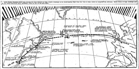
As aviation rapidly developed during the twentieth century, navigators discovered that the same measurement system used by experienced mariners worked equally well in the sky. A defining moment came in 1927, when Charles Lindbergh successfully navigated his historic transatlantic flight using navigation methods built around nautical miles. That achievement reinforced confidence in the system and accelerated its acceptance throughout the aviation industry.
Global Aviation Relies on a Single Navigation Standard
Modern aviation depends on worldwide consistency. Aircraft routinely cross multiple countries within a single flight, making standardized measurements essential. Both the International Civil Aviation Organization (ICAO) and the International Maritime Organization (IMO) require the use of nautical miles as the international standard for aircraft and ships. This shared language eliminates confusion between flight crews, air traffic controllers, dispatchers, and navigation systems operating across different regions.
The international nautical mile was officially standardized in 1929 during the First International Extraordinary Hydrographic Conference in Monaco. The United States adopted the international standard in 1954, while the United Kingdom followed in 1970. Although abbreviations such as NM, nmi, Nm, and M have all appeared in technical documents over the years, aviation universally recognizes the nautical mile itself as the fundamental unit of distance.
Nautical Miles Improve Fuel Planning and GPS Accuracy
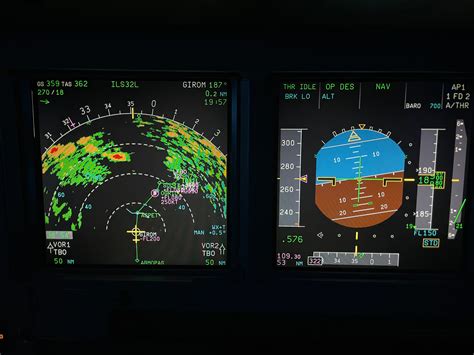
Modern flight management computers constantly calculate distance, speed, estimated arrival time, and fuel consumption. Because aircraft speeds are measured in knots, with one knot equal to one nautical mile per hour, every major navigation calculation uses compatible units. This consistency simplifies flight planning and reduces conversion errors that could otherwise affect operational efficiency.
In 1947, the ICAO explored replacing nautical miles with metric units as part of the emerging International System of Units. Although the metric system became widely accepted elsewhere, aviation continued using nautical miles because changing decades of charts, procedures, aircraft systems, and international regulations would have introduced unnecessary complexity. Today, the nautical mile remains one of aviation’s most enduring standards, proving that the most reliable solutions often stand the test of time.