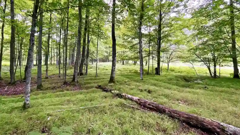
In the deeply forested landscape of Michigan’s Upper Peninsula, a quiet revolution in archaeology is unfolding. Cutting-edge drone-mounted lidar technology has pierced through the dense canopy to expose an expansive and highly sophisticated agricultural system built over 1,000 years ago by the ancestors of the Menominee Indian Tribe of Wisconsin. This discovery challenges long-standing misconceptions about Indigenous societies in the Great Lakes region and provides unprecedented insights into pre-Columbian land use, engineering, and social organization.
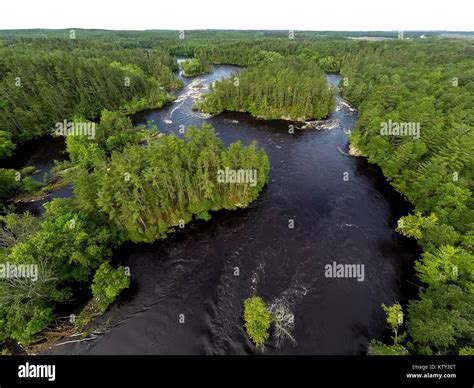
The discovery, centered around the Sixty Islands archaeological site along the Menominee River, is being hailed as one of the most significant agricultural revelations in North American archaeology. The raised ridge field systems date from approximately 1000 AD to 1600 AD, covering an area so vast that researchers believe they’ve only surveyed about 40% of it so far.
Lidar Unmasks a Hidden Legacy Beneath the Trees
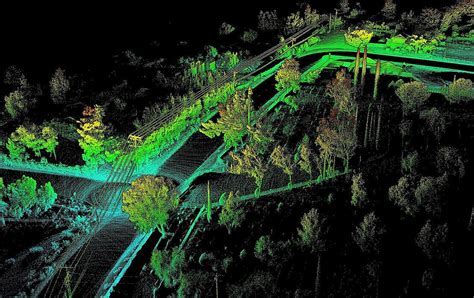
Unlike traditional aerial surveys, drone-based lidar (Light Detection and Ranging) emits pulses of laser light that bounce off surfaces, allowing archaeologists to generate high-resolution topographical maps even beneath dense forest canopies. This was especially critical for the Michigan Upper Peninsula, where decades of vegetation had obscured a thriving agricultural civilization.
The results were startling. The lidar revealed quilt-like arrangements of raised ridges, spanning nearly 70% of the surveyed 330-acre area. These parallel ridge fields, 4 to 12 inches in height, were used to grow corn, beans, squash, and other staples. Notably, their orientation appeared independent of environmental factors like sunlight angles or river flow, suggesting that individual farmers shaped the terrain based on familial or clan-based strategies rather than a central agricultural plan.
A Scale That Redefines Native American Agriculture
What distinguishes this discovery is not merely the existence of agriculture in the region but its immense scale and complexity. According to lead archaeologist Madeleine McLeester from Dartmouth, the agricultural expanse is nearly ten times larger than previously documented in the area. This overturns prevailing assumptions that Indigenous societies in the Great Lakes region were exclusively nomadic or small-scale horticulturists.
“This was not just gardening,” explains McLeester. “We’re talking about full-scale, intensive agriculture that would require organized labor, ecological knowledge, and long-term land management. It is the most complete ancient agricultural site ever documented in the eastern United States.”
A Cultural Landscape: More Than Just Farming
While the agricultural ridges are astounding in themselves, the site holds far more than fields. The lidar survey and excavation efforts uncovered:
- Circular dance rings, likely used for ceremonial and communal gatherings.
- Burial mounds, including previously undocumented ones and some thought to be destroyed decades ago.
- A rectangular foundation believed to be the remnants of a colonial-era trading post.
- Remains of 19th-century logging camps, showing how later industrial use partially disrupted the original landscape.
The site is part of a culturally significant region known as Anaem Omot, or “Dog’s Belly” in Menominee. Already listed on the U.S. National Register of Historic Places, Anaem Omot had been previously excavated in the mid-20th century but lacked the comprehensive data made possible by today’s remote sensing tools.
Buried Knowledge: Excavations Confirm Continuous Cultivation
In August 2023, researchers conducted careful excavations on three ridged fields positioned at different distances from the Menominee River. Radiocarbon dating of charcoal samples confirmed that these fields were first constructed around the year 1000 AD, during the Late Woodland period. Even more impressively, the ridges had been rebuilt and maintained over a 600-year span, a testament to sustained agricultural innovation.
Soil analyses revealed the use of wetland sediments to enhance fertility, and charcoal and ceramic sherds found within the ridges point to a practice of using domestic refuse as compost. These techniques showcase an advanced understanding of agroecology and resource recycling, indicating the ancestors of the Menominee were not just cultivating crops, but modifying the ecosystem itself for optimal yield.
Decentralized But Coordinated: A New Societal Paradigm
Perhaps most remarkable is the socio-political implication of the findings. The scale and sustainability of the farming system would traditionally be attributed to a state-level or hierarchical society. Yet, archaeological and ethnographic records consistently describe the region’s inhabitants as egalitarian and kin-based.
This paradox invites a rethinking of what complex society means. “This wasn’t centralized, top-down governance,” says McLeester. “It was community-driven planning and sustained intergenerational collaboration.” This presents a new model of complexity, one that challenges the Eurocentric equation of hierarchy with sophistication.
Lidar’s Role in Rewriting Forest Histories
Drone lidar didn’t just illuminate past human activity — it also reshapes ecological assumptions. For centuries, the Upper Peninsula was thought to have always been thickly forested, but the size of the ridged fields implies large portions of forest had been intentionally cleared and managed for agriculture. This transforms how we understand the region’s landscape history, placing humans as active ecosystem engineers long before European settlement.
The project’s success was underpinned by a collaborative approach, guided by the Menominee Indian Tribe of Wisconsin. Archaeologists worked closely with David Grignon, the tribal historic preservation officer, and the late David Overstreet, a long-time researcher on Menominee archaeology. Their involvement ensured that the research was respectful, accurate, and community-aligned.
What Lies Beyond the Tree Line
Despite the breadth of the survey, researchers believe they’ve only scratched the surface. The Sixty Islands site likely extends far beyond the 330 acres examined. Given the preservation quality and diversity of findings, it raises the question: could much of eastern North America have once been covered in similar ridged agricultural landscapes?
“Most field systems across North America have been erased,” explains Jesse Casana, Dartmouth professor and remote sensing expert. “Urbanization, plowing, logging — all of it tends to wipe out subtle topography. But here, in this one quiet corner of Michigan, we’ve found a time capsule of land use, almost miraculously preserved.”
The next phase will involve mapping ancestral Menominee villages, further excavations, and likely, more lidar flights. These efforts not only contribute to academic knowledge but also support cultural reclamation and heritage preservation for the Menominee people.
Implications Beyond Borders
Beyond its regional importance, this discovery reframes the broader narrative of pre-Columbian North America. It punctures myths about Native American peoples being passive stewards of untouched wilderness. Instead, it reveals a legacy of innovation, environmental mastery, and social cohesion.
This is not just an archaeological site; it is evidence of civilization — one built without cities or palaces, but no less sophisticated in its ingenuity. From the coordination of ridge-building to ecological adaptation, the ancestors of the Menominee left behind a landscape of knowledge hidden for centuries beneath forested silence. Now, thanks to drone technology and respectful collaboration, that story is finally emerging — one ridge, one sherd, one laser pulse at a time.


