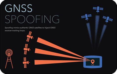
GNSS jamming and spoofing are serious threats that impact navigation systems. Jamming occurs when someone intentionally interferes with GNSS signals, making it hard for receivers to connect to satellite signals. This interference can make the GNSS system ineffective for users in the affected area. On the other hand, spoofing involves sending fake satellite signals to trick GNSS receivers into calculating incorrect position, navigation, and timing data.
These issues are especially prevalent in conflict zones, like the Black Sea and the Middle East. Currently, it is challenging to detect these interference areas from afar, so pilots often rely on reports from others in the field. Signs of potential GNSS radio frequency interference (RFI) include onboard system alerts, such as GNSS degradation messages, major discrepancies between the aircraft’s actual and displayed position, or unusual time indications. Controllers may also notice unexpected turns or trajectory deviations on their displays.
The consequences of GNSS interference can be severe. Users may experience a lack of GNSS navigation and inertial navigation system (INS) availability. Sometimes, the false signals are strong enough to mislead aircraft systems. This can result in degraded performance of time-sensitive systems like clocks, fuel computation systems, and flight management systems (FMS). Pilots might receive false alerts from the Enhanced Ground Proximity Warning System (EGPWS), like ‘PULL UP’ warnings during cruise. Additionally, GNSS interference can hinder arrival and approach procedures and cause erroneous display data during landing, leading to confusion about runway alignment.
Route deviations or uncommanded turns could potentially lead to airspace violations, as aircraft may stray into restricted areas. This might also cause separation loss with other planes, especially if Automatic Dependent Surveillance (ADS) is used and shows incorrect positions. Such scenarios can result in false alerts about separation or actual incidents going unnoticed.
To defend against these threats, several measures can be implemented at different levels. Operationally, pilots can revert to traditional radio navigation methods like VOR, DME, and ILS. Air traffic control can provide radar vectoring to assist pilots. Pilots should report any GNSS-related issues promptly, while controllers need to remain vigilant and consider that erratic behavior may stem from GNSS interference.
At the organizational level, collecting and analyzing reports is crucial. Informing operators and crews about affected regions and assessing the risk of GNSS loss is essential. This includes understanding how other systems that depend on reliable GNSS signals might be impacted. Procedures should be established for dispatching aircraft with non-operational radio navigation systems, guiding crews on specific actions when flying through affected areas or landing at impacted airports. For instance, switching off the Terrain Look Ahead function can reduce unnecessary alerts, and disabling GNSS position updates can prevent problems from spreading to other systems.
Training for flight crews and air traffic controllers should emphasize awareness of these issues. Maintaining ground navigation infrastructure, such as VOR/DME systems, and ensuring adequate surveillance coverage with radar or Multilateration (MLAT) is vital. Finally, systems that support early detection of aircraft deviations can help manage these risks effectively.


")


