Grid Navigation
Definition
Grid Navigation is a method of navigation that uses a grid overlay on a map projection instead of relying solely on true or magnetic north for direction. This technique became essential, especially in polar regions where traditional navigation methods faced challenges.
Description
Before the introduction of Flight Management Systems (FMS) and reliable navigation tools like the Global Positioning System (GPS), navigating long distances in polar areas was quite difficult. There were three main reasons for this:
-
Convergence of Meridians: When flying a route that isn’t directly north or south, pilots must constantly adjust their heading.
-
Magnetic Poles Proximity: The magnetic poles cause significant changes in compass readings, making them unreliable over short distances.
-
Limited Ground Navigation Aids: There were few navigation aids available, and they were spaced far apart.
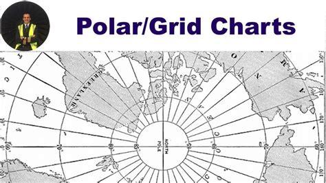
To tackle these issues, Grid Navigation was developed in the early 1940s and continued to be used until the late 20th century. In polar areas, this navigation method relies on a grid, usually aligned with a specific longitude, overlaid on Polar Stereographic projection charts. The aircraft’s gyro compass is aligned with this grid, either before takeoff or during the flight, and adjustments are made for longitude changes and gyro precession through celestial navigation sightings.
The Prime Meridian (0 degrees) is often used as the reference meridian, also known as the “Greenwich Grid.” Grid Navigation was also applied in mid-latitudes, allowing pilots to fly along a great circle track while maintaining a constant heading.
Grid Overlay Definitions
Several key terms are important in understanding Grid Navigation:
-
Grid Convergence: This is the difference between the true track and the grid track. It indicates how much adjustment is needed based on the local meridian compared to the reference meridian.
-
Datum Meridian: The meridian where true north aligns with grid north.
-
Grivation: The difference between magnetic and grid heading, which combines variation and convergence.
-
Variation: The angle between magnetic north and true north at a specific location.
When converting between different headings, there are specific rules to follow:
-
True/Magnetic: “Variation east, magnetic least” or “variation west, magnetic best.”
-
Grid/True: “Convergence east, true track least” or “convergence west, true track best.”
-
Magnetic/Grid: “Grivation east, magnetic least” or “grivation west, magnetic best.”
Practical Application
Pilots flying between airports in polar regions, like Iqaluit (CYFB) to Resolute Bay (CYRB), often rely on Grid Navigation techniques. For instance, Iqaluit is in an area where magnetic compasses are generally reliable, but due to its proximity to the compass unreliability zone, using a grid reference is common.
For a flight from Iqaluit to Resolute Bay, the crew calculates the grid heading of the runway. They can do this in two ways:
-
By converting magnetic heading to true heading and then to grid heading using variation and convergence.
-
By calculating grivation first and then converting directly from magnetic to grid.
For example, if the runway heading is 345°M and the magnetic variation is 29°W, the calculations would go as follows:
-
Method 1: Start with 345° – 29° = 316°T. Then, since the convergence is east, add 69° to get 025°G.
-
Method 2: Calculate grivation by adding 29°W and 69°E, resulting in 40°E. Apply this to the magnetic heading to also arrive at 025°G.
Once calculations are done, the aircraft aligns with the runway, and the gyro compass is switched to read 025°. After takeoff, the crew continuously checks and corrects the grid heading as they approach Resolute Bay, located significantly farther north.
In summary, pilots navigating in polar regions or areas where magnetic compasses are unreliable must use Grid Navigation techniques for safer and more accurate flights. Understanding grid overlays and the associated calculations are crucial for successful navigation.


")
")
")
")
