Navigating the skies requires precision, preparation, and the ability to respond decisively when things go off course. In aviation, one of the most unnerving experiences a pilot can encounter is becoming lost during flight. Despite technological advancements and modern avionics, the possibility remains — and that’s where lost procedures play a pivotal role.
Understanding Aviation Lost Procedures
Aviation lost procedures are standardized protocols that guide pilots in regaining orientation, ensuring safety, and preserving situational control when spatial or navigational uncertainty arises. The FAA, through the Airman Certification Standards (ACS) and publications like the Pilot Handbook of Aeronautical Knowledge, outlines clear expectations for how pilots should respond.
At the heart of these procedures lies a timeless acronym: the 5 C’s — Circle, Confess, Climb, Conserve, Communicate — a mnemonic that forms the backbone of practical lost procedures and risk management strategies.
The 5 C’s: Core of Lost Procedures
Circle
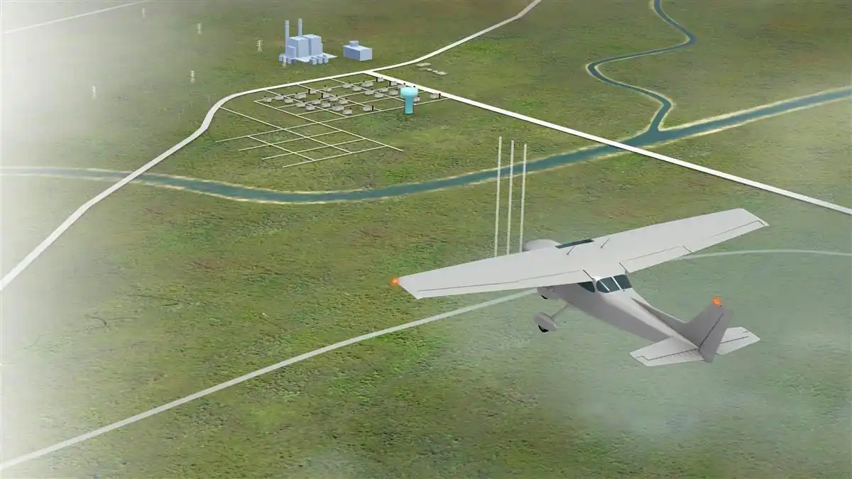
When a pilot suspects they’ve lost their bearings, the first instinct must be to stabilize the aircraft and circle. By doing so, the pilot minimizes further disorientation and prevents drifting further off-course. Circling buys time to assess the surroundings, match visual cues with sectional charts, and evaluate flight instruments.
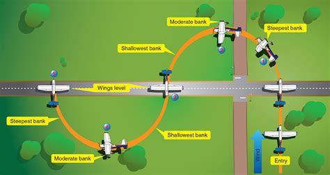
This maneuver should be performed at a safe altitude, avoiding erratic movements, and maintaining visual references when available.
Confess
Admitting the loss of position is not a sign of failure — it’s a vital safety decision. As soon as the pilot recognizes the uncertainty, they should:
- Record the time and approximate location where disorientation began.
- Avoid rash decisions fueled by stress or pride.
- Acknowledge the situation to air traffic control (ATC) or other relevant entities using proper phraseology, such as:
“Any station, [Callsign], lost, request assistance.”
Timely confession allows support systems to activate radar services, frequency monitoring, and other aids to assist the pilot efficiently.
Climb
The axiom “climb to cope” embodies the advantage of altitude during navigation difficulties. Climbing, provided weather and airspace permit, offers two significant benefits:
- Improved radio and navigation signal reception
- Wider visual range to detect landmarks, VORs, or terrain features
Pilots should combine their climb with circling to prevent compounding navigational errors.
Conserve
Once the aircraft is stabilized, fuel management becomes critical. To maximize endurance and range, pilots should:
- Adjust to maximum endurance power settings
- Lean the mixture properly
- Monitor fuel burn rates and calculate remaining time aloft
An awareness of fuel limits is key to making informed decisions about precautionary landings if necessary.
Communicate
This step encompasses utilizing every available communication tool. Pilots should attempt contact on the area’s working frequency, approach control, or 121.5 MHz (Guard) if unable to establish contact otherwise.
If communication fails:
- Transmit a PAN-PAN report.
- Switch transponder to 7700 (emergency).
- Repeat position, situation, and intentions “in the blind” on Guard.
Example PAN Report Format:
“PAN-PAN, PAN-PAN, PAN-PAN, [Callsign], lost position, last known 5 miles west of VOR XYZ, fuel 2 hours remaining, requesting vectors to nearest airport.”
Leveraging Navigational Aids and Visual Cues
While executing the 5 C’s, pilots must leverage all available resources to reestablish situational awareness. These include:
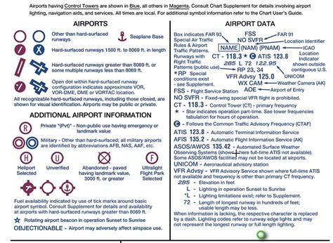
Sectional Charts and Visual Landmarks
Pilots should rotate the sectional to match their heading, search for distinctive terrain features, and correlate them with chart symbols. Rivers, ridgelines, highways, or large urban areas serve as effective markers.
VOR and NDB Navigation
Traditional NAVAIDs like VORs and NDBs still play a crucial role:
- Tune, identify, and verify station signals.
- Use radials and bearings to triangulate current position.
- Plot courses to reintercept the original route or divert to a known waypoint.
Electronic Flight Bags and GPS
Modern cockpits equipped with GPS-based navigation and electronic flight bags (EFBs) offer significant situational tools:
- Activate the NRST function to identify nearby airports or waypoints.
- Use moving map displays to pinpoint relative location and direction.
- Cross-check instruments against EFB data to avoid sole reliance on any one system.
Contacting Air Traffic Control and Radar Services
ATC is a critical ally during a lost aircraft scenario. Services available include:
- Basic Radar Services
- Radar Traffic Information Service (Flight Following)
- Tower, Approach, and Center frequencies
When in doubt, pilots should initiate contact and comply with all instructions. ATC may issue a unique transponder squawk code to identify the aircraft on radar and coordinate routing or emergency procedures.
When to Declare an Emergency
Declaring an emergency is not to be feared — it is a lifesaving option when the situation escalates beyond manageable uncertainty. Indications for this include:
- Low fuel
- Nightfall with no known position
- Rapidly deteriorating weather
- Complete loss of navigation capability
Use transponder code 7700 and transmit a clear, concise emergency message including your callsign, nature of emergency, location (if known), and intentions.
Executing a Safe Landing
If navigating back to the intended destination is not feasible, and fuel or daylight limitations arise, executing a precautionary landing becomes necessary. Pilots should:
- Circle the field at a safe altitude.
- Survey for obstacles, wind direction, and runway suitability.
- Attempt communication on Guard with the local tower or CTAF.
- Use standard traffic patterns and estimate runway length and width before touchdown.
Landing at a remote or unknown field may be intimidating, but a controlled landing under power is always safer than running out of fuel in-flight.
Common Errors in Lost Procedures
Despite training, pilots may commit preventable mistakes under pressure. These include:
- Neglecting to identify landmarks
- Failing to lean the engine or reduce power to conserve fuel
- Incorrect heading indicator settings
- Inadequate altitude for visibility
- Overlooking available radio aids
- Delaying or avoiding asking for help
Recognizing and mitigating these errors through recurrent training and scenario-based simulation is essential for all aviators.

Integrating Lost Procedures into Risk Management
Lost procedures are not isolated maneuvers but part of a larger risk management framework outlined by the FAA. Through scenario analysis and training, pilots must demonstrate:
- Knowledge of available resources and navigational aids
- The ability to assess collision hazards
- Maintaining situational awareness despite distractions
- The judgment to seek assistance or declare an emergency in a deteriorating scenario
This structured approach ensures that pilots are not only competent navigators but also disciplined decision-makers under stress.
Conclusion
Mastering lost procedures is not merely about memorizing the 5 C’s — it’s about cultivating a mindset of calm, resourcefulness, and proactive decision-making. Whether flying cross-country in visual conditions or navigating through Class B airspace, every pilot must be equipped to respond confidently when the unexpected arises. The combination of technical knowledge, risk assessment, and communication can transform a potential crisis into a controlled and safe resolution.
Frequently Asked Questions
What should I do first if I realize I’m lost in flight?
The first step is to circle and stabilize the aircraft. This prevents further deviation and allows time to assess the surroundings. Once stabilized, proceed with the full 5 C’s: Circle, Confess, Climb, Conserve, Communicate.
When should I declare an emergency while lost?
Declare an emergency when the situation threatens the safety of the flight — such as low fuel, loss of navigational capability, nightfall with uncertain position, or deteriorating weather conditions. Squawk 7700 and transmit on Guard (121.5 MHz).
Can I use my phone or tablet if I’m lost during flight?
Yes, if the aircraft is equipped with an EFB (Electronic Flight Bag) or tablet-based navigation tools like ForeFlight or Garmin Pilot, they can assist in pinpointing position via GPS and offer nearest airport options. Always cross-reference with onboard instruments and charts when possible.


