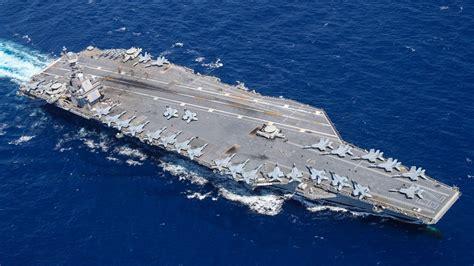
Modern U.S. aircraft carriers are floating cities, engineered to project power across oceans with astonishing precision. Their navigation suites normally rely on GPS, radar, inertial systems, and satellite-linked software to place a 100,000-ton warship exactly where commanders want it. Yet American naval doctrine assumes those tools may vanish without warning. In a high-end conflict, satellites are fragile targets, and GPS signals are among the first systems adversaries aim to disrupt.
When that digital scaffolding collapses, navigation does not stop. It simply changes character. The U.S. Navy plans for a world where screens go dark, antennas fall silent, and sailors must fall back on knowledge older than electricity itself. This is not nostalgia; it is resilience engineered into doctrine, training, and culture.
Celestial navigation, once dismissed as obsolete, sits quietly behind the curtain as a strategic insurance policy. Long before satellites orbited Earth, mariners crossed oceans by reading the sky with mathematics and patience. Those principles still work, regardless of jamming, hacking, or orbital debris, because the stars do not care about electronic warfare.
The most important shift is mental rather than mechanical. Without GPS, navigation becomes an act of continuous reasoning. Position is inferred, checked, and corrected through observation, calculation, and disciplined record-keeping. Accuracy emerges from process, not automation.

Celestial Navigation as a Strategic Fallback
Celestial navigation determines position by measuring angles between celestial bodies and the horizon. Using a sextant, navigators capture the altitude of the Sun, Moon, planets, or selected stars. Those measurements are combined with precise time and published almanacs to calculate latitude and longitude. The math is exacting, but the physics are timeless.
This method does not drift blindly. Each observation tightens the solution. Multiple sightings refine the fix. Errors reveal themselves through inconsistency. On a carrier, teams cross-check results, ensuring that no single miscalculation sends the ship astray. The ocean becomes a coordinate system written in light.
Paper Charts, Compasses, and Human Judgment
Without radar, navigators rely on gyrocompasses and magnetic compasses to maintain heading. Speed is tracked through logs and engine data, feeding dead-reckoning plots on paper charts. Wind, current, and sea state are estimated and adjusted continuously. Every mile traveled is written down, scrutinized, and challenged.
This analog workflow slows nothing essential. Aircraft carriers do not need second-by-second precision to remain operational. They need confidence in relative position, safe water beneath the keel, and predictable maneuvering space. Analog navigation provides all three when practiced correctly.
Real-World Proof From the Pacific
In 2022, the USS Essex deliberately sailed from Hawaii to California using only celestial navigation and paper tools. Over five days and 1,800 nautical miles, the ship remained within roughly one nautical mile of its intended track. The exercise was not symbolic. It validated training, exposed skill gaps, and proved that large naval vessels can navigate accurately without electricity.
That success explains why the Navy reinstated formal celestial navigation training in 2016. The goal was not to replace GPS, but to ensure it never becomes a single point of failure.
Why Redundancy Wins Wars at Sea
Aircraft carriers embody layered redundancy. Nuclear reactors back up power. Human skill backs up machines. Celestial navigation ensures that even in a contested space environment, U.S. naval forces retain freedom of movement. The stars provide a map no adversary can jam, hack, or shoot down.

When technology falters, knowledge endures. That quiet truth keeps carriers moving, missions alive, and oceans navigable, even when the digital world goes dark.


: A Pilot’s Guide to Radar-Guided Landings")


