Parachute Jump Areas (PJAs) represent a critical consideration for pilots navigating VFR operations, especially in complex airspace environments like the Washington D.C. Special Flight Rules Area (SFRA). For those planning routes near or through PJAs in Class G or E airspace, a comprehensive understanding of the relevant procedures, legal obligations, and best practices is essential to maintain operational safety and compliance.
What Are Parachute Jump Areas (PJAs)?
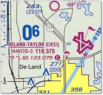
Parachute Jump Areas (PJAs) are designated locations where routine skydiving activities occur. They are charted similarly to other special-use airspace but carry unique operational characteristics. PJAs may not always be active, yet they are still indicated on aeronautical charts. This means that pilots cannot assume activity based solely on chart presence.
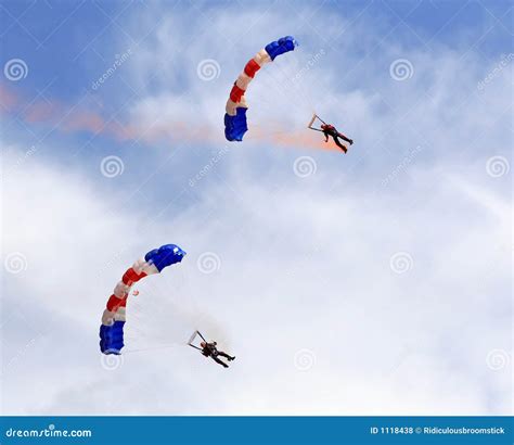
The primary concern with PJAs stems from the vertical and lateral presence of parachutists, often descending from altitudes as high as 14,500 feet MSL. These jumpers pose significant hazards to aircraft operating VFR, particularly at lower altitudes. PJAs are generally located around small to mid-size airports, which further complicates airspace congestion and awareness.
The Regulatory Framework: CFR 14 §105.13
Under 14 CFR 105.13, skydiving operations require that the jump aircraft maintain communication with Air Traffic Control (ATC) during jump activities. This regulation provides VFR pilots with a layer of protection and awareness, assuming they are actively communicating with ATC through Flight Following.
Despite PJAs being situated in uncontrolled airspace (Class G or E), jump pilots are still expected to make position reports on UNICOM frequencies. While not always enforced rigorously, these communications serve as additional tools for situational awareness among general aviation pilots transiting nearby.
Operational Best Practices for VFR Flight Near PJAs
The consensus among experienced pilots and jump operators is that while a direct route through a PJA might be legally permissible, it is not operationally advisable without enhanced situational awareness. Pilots should consider the following best practices:
- File for Flight Following: This provides real-time advisories from ATC. Controllers will generally be aware of jump zone status and can reroute traffic accordingly.
- Monitor UNICOM Frequencies: If possible, monitor the local UNICOM where the jump aircraft operates. Most jump pilots announce climb and jump activity here.
- Maintain a 5 NM Buffer: Even though parachutists typically remain within a 3 NM radius from the airport, a 5 NM buffer adds an essential safety margin.
- Request PJA Status from ATC: When on Flight Following, asking controllers about the current jump status is encouraged. Many PJAs only operate during certain times or days.
Real-World Scenario: KCHO to KHEF and the FLUKY Gate
Consider a flight from Charlottesville–Albemarle Airport (KCHO) to Manassas Regional Airport (KHEF). The direct route leads through multiple interlinked PJAs located just outside Washington D.C.’s Class B airspace, near the FLUKY Gate—a commonly used entry point into the SFRA.
This routing poses several considerations:
- The PJAs intersecting the route include areas near Warrenton-Fauquier Airport, Warrenton Air Park, and Flying Circus Aerodrome.
- These jump zones have different operational characteristics. For example:
- Warrenton-Fauquier Airport: 5 NM radius, SFC–10,000 ft, daily operations.
- Warrenton Air Park: 2 NM radius, up to 14,500 ft, daily sunrise to sunset.
- Flying Circus Aerodrome: Active weekends only, 1000–1959 hrs, up to 7,000 ft.
Given this, pilots are advised to plan their SFRA entry route carefully. While a direct path through the FLUKY Gate may be ideal for fuel and time efficiency, adjusting the route slightly north or east to bypass these PJAs could enhance safety and reduce ATC workload.
Flight Following: The Pilot’s Safety Net
Flight Following, a VFR service provided by ATC, is perhaps the most powerful tool a VFR pilot has when navigating near PJAs. Since jump aircraft must communicate their intentions to ATC, controllers can advise transiting pilots whether a particular jump zone is active.
In this context, Flight Following functions as a dynamic airspace management assistant. Rather than relying solely on static chart information, pilots gain access to real-time traffic and hazard data. In the case of PJAs, this could mean the difference between a safe transition or a close encounter with descending skydivers.
The Limitations of ForeFlight and Other Digital Tools
A surprising observation from many pilots is the lack of detailed activity data in apps like ForeFlight. While PJAs are charted in these platforms, active hours or real-time status are often omitted or buried in supplements.
For example, the New England Chart Supplement provides detailed PJA information—including radii, altitudes, and times—but many pilots remain unaware of these back-page entries. When planning flights, consulting both the chart supplements and NOTAMs is highly advisable.
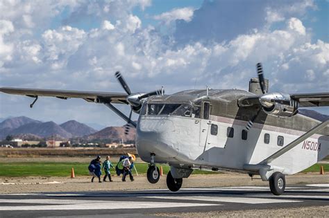
Skydiving Operations: Understanding the Jump Profile
To better appreciate the risk PJAs pose, one must understand the jump aircraft and jumper behavior. Most jumpers exit the aircraft between 10,000 and 14,500 feet, depending on the drop zone type and experience level. Once deployed, parachutes descend slowly, and jumpers can drift due to wind up to several miles away from the drop zone.
However, experienced jump pilots tend to conduct tight drop profiles, rarely operating more than 6 NM from the airport. That said, unpredictability remains, especially in high-wind scenarios or specialty events like canopy formation work or wingsuit flights, where glide distances increase significantly.
Case for Rerouting: When Safety Trumps Efficiency
While the direct path from KCHO to KHEF via the FLUKY Gate offers optimal efficiency, routing decisions should be evaluated with risk mitigation in mind. Even with Flight Following, pilots bear ultimate responsibility for “see and avoid.”
In such cases, a better plan may be:
- Fly north of the PJAs before cutting east toward FLUKY Gate.
- Communicate your planned route early with ATC.
- Allow ATC to modify or clear direct routing if they confirm the jump areas are inactive.
This approach ensures that even if jump operations begin unexpectedly or communication gaps arise, the aircraft is positioned well outside the potential conflict zone.
Key Takeaways for Pilots Navigating PJAs
Pilots must treat PJAs as dynamic risk zones, not static chart elements. When planning VFR flights near or through them, particularly in complex airspace like that around Washington D.C., the following are critical:
- Never assume a PJA is inactive based on lack of published hours alone.
- Use Flight Following whenever available—ATC holds the most current information.
- Monitor UNICOM if you can, especially if not on ATC frequency.
- Stay at least 5 NM clear unless you have confirmation of inactivity.
- Review Chart Supplements—ForeFlight and similar tools may not display full operational context.
The ability to identify, understand, and safely navigate around PJAs reflects sound airmanship and prudent judgment. In increasingly congested skies, such discretion is not merely a matter of best practice—it’s an imperative.


 in Aviation")
")


