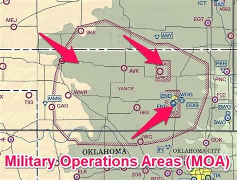
The Federal Aviation Administration (FAA) categorizes six types of SUA: Prohibited Areas, Restricted Areas, Warning Areas, Alert Areas, Controlled Firing Areas (CFAs), and Military Operations Areas. Among these, MOAs are perhaps the most misconstrued due to their flexible access for civilian traffic and dynamic activity schedules.
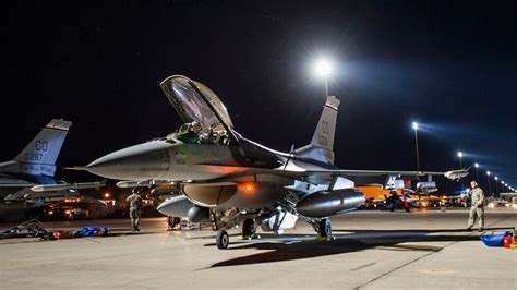
A Military Operations Area is designated for military training flights, including aerial combat, low-level navigation, and formation flying. Unlike Restricted or Prohibited areas, MOAs do not legally bar civilian aircraft from entry. However, they do represent active training zones, which means a VFR (Visual Flight Rules) pilot entering an active MOA could find themselves sharing airspace with high-speed military jets.
Debunking Myths: Legal Access vs. Practical Safety
MOAs operate under a unique rule set. According to AIM 3-4-5, while VFR aircraft can legally fly through an active MOA without clearance, it is strongly advised to contact the controlling agency for traffic advisories. IFR (Instrument Flight Rules) traffic, on the other hand, is generally rerouted by ATC to avoid conflicts with military training.
While the law does not prohibit GA pilots from traversing active MOAs, best practice and common sense certainly do. The absence of a restriction does not equate to an absence of risk. Pilots should take proactive measures to determine MOA status and communicate with controllers.
Planning Around MOAs: When Are They Active?
MOA schedules are fluid and can vary from day to day. Some general patterns do exist — military training is usually reduced on weekends and federal holidays. Yet, exceptions abound. Special exercises and unscheduled drills can activate MOAs even during off-peak times.
To check a MOA’s active status:
- Use the FAA’s Special Use Airspace website
- Call 1-800-WX-Brief with the MOA name and coordinates ready
- Use VFR Sectionals, which often list published operating times on the chart edge
- Tap into apps like ForeFlight, where MOAs are clickable for live updates
- Contact the Flight Service Station (FSS) or the controlling agency listed for that MOA
Though sectional charts provide operational time blocks, these are often outdated or non-specific to the day and time you plan to fly. The FSS is consistently the most accurate source of MOA activity.
Altitudes Matter: Vertical Separation and Tactical Use
MOAs are often designed with altitude stratification in mind, providing military aircraft sufficient space to maneuver while offering civilian pilots a chance to fly above or below the operational layer. These vertical limits are published and should be reviewed thoroughly.
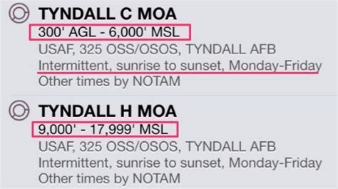
For example, if a MOA extends from 5,000 feet MSL to FL180, VFR pilots can remain below that floor with minimal risk. Alternatively, those on IFR flight plans can be vectored around or over the MOA. However, in rare cases — like Tyndall C MOA, which drops as low as 300 feet AGL — even low-level VFR routes become challenging.
Navigating such airspace without prior planning invites unnecessary risk. Knowing the floor and ceiling of the MOA is one of the easiest and most effective ways to avoid surprises.
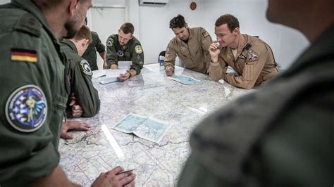
Communication Protocols: Who You Need to Talk To
While not mandatory, communication with the controlling agency — typically a regional Air Route Traffic Control Center (ARTCC) — is highly encouraged. These agencies provide traffic advisories, alert pilots to ongoing exercises, and facilitate safe passage.
You can obtain the correct frequency in three ways:
- From VFR sectional charts, which include frequency listings
- Through ForeFlight and similar aviation apps
- By contacting Flight Service Stations directly
Always confirm whether the MOA is under the jurisdiction of Center (en route ATC), especially if multiple frequencies are listed. Monitoring the appropriate channel while traversing an active MOA allows for real-time situational awareness.
Real-World Applications: Examples from California and Oregon
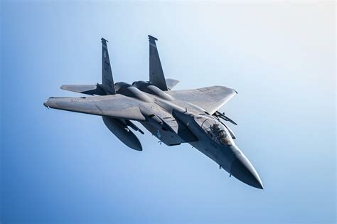
The Goose South MOA in southern Oregon, often used for F-15 training, is a prime example of a zone that appears intimidating but can be safely crossed with coordination. The chart provides frequency listings, operational times, and altitudes, yet real-time updates from Center remain indispensable.

Similarly, the Lemoore MOA in California is vast and persistent. On a typical weekday, fighter aircraft may be practicing dogfighting maneuvers at high speeds. Yet, during weekends or federal holidays, the airspace is often quiet and inactive. Without making a quick call or checking ForeFlight, a pilot might unnecessarily reroute.
The Cost of Ignorance: MOAs and the Risk of Midair Conflicts
Flying blind into an active MOA is not illegal — but it’s dangerous. Military aircraft often operate at extremely high closure rates, sometimes exceeding 600 knots combined. Many use non-standard patterns or engage in unpredictable maneuvers that are difficult to detect visually.
Moreover, military jets are often focused on training objectives, not on scanning for VFR aircraft. A midair conflict, while rare, can occur in the absence of coordination or communication. The controlling agency may not be able to provide separation, but they can provide situational awareness — a crucial safety layer.
Simplifying the MOA Planning Process
Though MOAs introduce another element into preflight planning, modern tools have made the process streamlined and accessible. Here’s a simple flow pilots can follow:
- Identify MOAs along the route using a VFR sectional or EFB
- Check their published times and altitude ranges
- Cross-reference activity status via FSS or ForeFlight
- Monitor or contact the controlling agency near the MOA boundary
- Adjust your altitude or route accordingly if activity is ongoing
This approach adds just a few minutes to planning but drastically improves operational safety and airspace efficiency.
Cultural and Operational Relevance: Why MOAs Exist
MOAs serve a strategic national defense function, allowing pilots from units like the Air National Guard, Navy, and Air Force to hone their skills in realistic scenarios. These areas are carefully designed in regions that balance training utility with airspace congestion levels, often appearing in sparsely populated states like Nevada, Oregon, and Arizona.
Civilian cooperation helps maintain the readiness of these forces while preserving the freedoms enjoyed by the broader GA community. Mutual respect, situational awareness, and smart planning create a shared airspace that functions safely and effectively.
Conclusion: MOAs Are Manageable With the Right Tools
Military Operations Areas do not need to be feared or avoided. They are neither airborne minefields nor no-fly zones, but essential components of a comprehensive airspace system. Understanding their purpose, structure, and dynamic nature allows civilian pilots to fly efficiently and safely through or around them.
By embracing technology, education, and communication, pilots can seamlessly integrate with military operations without compromising their own missions or personal safety. In short, knowledge remains the most powerful tool in the sky when it comes to navigating MOAs.


: Navigating Danger Zones in U.S. Airspace")


