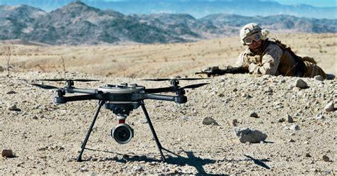
In an era defined by asymmetrical warfare and rapidly evolving surveillance technology, small man-portable drones have emerged as indispensable assets on the modern battlefield. From the war-torn ruins of Syria and Ukraine to the dense jungles of Myanmar and the contested hills of Nagorno-Karabakh, these compact unmanned aerial vehicles (UAVs) are redefining what it means to conduct real-time reconnaissance at the infantry level. Their portability, affordability, and adaptability make them force multipliers, but their vulnerabilities—legal, technical, and operational—demand strategic forethought.
The Rise of Portable UAVs in Modern Conflict Zones
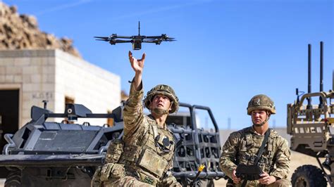
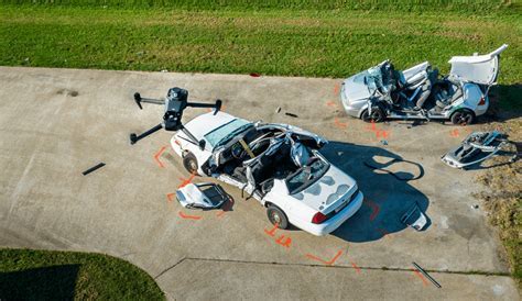
Small drones have proven invaluable for forward observation, artillery correction, and situational awareness. Battlefield use cases in Ukraine, for instance, showcase how quadcopters are leveraged to spot enemy armor and coordinate indirect fire within seconds. These drones bridge the gap between traditional scouting and high-altitude ISR (intelligence, surveillance, reconnaissance) platforms, democratizing real-time intelligence gathering for frontline units.
Their utility is particularly pronounced when integrated with platforms like ATAK (Android Team Awareness Kit). Open-source plugins allow even hobby-grade drones such as those from DJI to feed live data into tactical planning tools. This software interoperability is a game-changer, transforming simple UAVs into components of a broader digital battlespace.
However, ease of use often masks complex risk layers. While many drones support real-time video and GPS-tagged location data, these features can be exploited. Drones from Chinese manufacturers like DJI are often equipped with geofencing, telemetry upload, and encrypted data logging—features that could betray operator positions under certain conditions.
Counter-Drone Threats and the Arms Race of the Air
As drone use proliferates, counter-UAS (Unmanned Aerial Systems) technologies are evolving in tandem. Jamming systems, from super-soaker-sized field units to bulky truck-mounted arrays, are increasingly capable of forcing UAVs to land or return to base. In urban or contested zones, these jammers can render small drones temporarily or permanently inoperable.
Yet, there are limitations to counter-UAS systems. Their deployment is neither ubiquitous nor foolproof. Most rely on detecting known control frequencies or signature telemetry protocols, which means that well-configured custom builds or frequency-hopping systems may still slip through undetected.
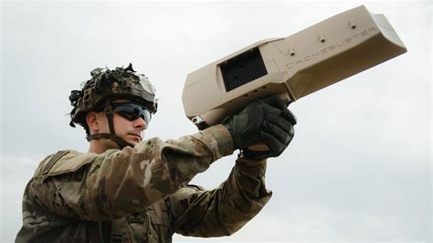
Moreover, many counter-drone tools are not truly portable—some resemble Nerf blasters, others require vehicular platforms. Until technology shrinks further, infantry-borne counter-UAS capability remains aspirational, not standard.
RTF Drones vs. Custom Builds: Navigating the Reliability Divide
Out-of-the-box drones—commonly referred to as RTF (ready-to-fly) models—offer simplicity but come with significant operational caveats. Platforms like DJI’s Mavic series require DRM connectivity, are often geofenced in sensitive locations, and may ‘phone home’ when connected. During conflict or grid-down scenarios, this becomes a liability.
Custom drones, particularly those built using Ardupilot or Arducopter, bypass these constraints. They offer:
- Offline GPS navigation
- Stabilized or manual flight modes
- Autonomous waypoint execution
- No telemetry backhaul unless configured
Such platforms can calculate moving drop points and execute tactical maneuvers unavailable to consumer drones. However, building and flying these drones requires time, expertise, and infrastructure—commodities often lacking in emergencies or combat zones.
Privacy, Telemetry, and the Chinese Data Question
Several contributors to the discourse warn of forensic risks. In one notable 2018 case, analysts at VTO Labs extracted credit card data from a downed DJI drone. With modern Remote ID laws requiring telemetry transmission and data logging, the danger of data leakage is even more acute.
The concern goes beyond commercial misuse. Given DJI’s opaque data practices and Chinese origins, suspicions abound that flight data—including location, imagery, and user metadata—could be routed to foreign intelligence networks. DJI’s ability to remotely disable drones in Iraq and elsewhere reinforces this unease.
Alternatives like Autel EVO II and Parrot Anafi promise more privacy, but scrutiny reveals Autel is also Chinese-owned. Only platforms like Skydio, based in the U.S., appear to offer fully sovereign data pathways, although full trust still requires technical validation and potentially firmware inspection.
Operational Tactics and the Risks of Detection
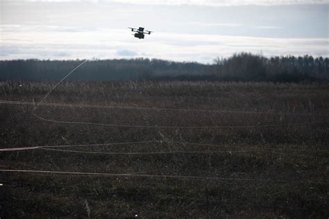
While drones extend vision beyond line-of-sight, they expose operators in new ways. Signal emissions—radio control links, FPV video feeds, GPS pings—are all detectable with the right equipment. Jammer triangulation, RF spectrum scanning, and thermal imaging can pinpoint drone pilots in seconds, especially when flights occur near critical infrastructure or combat zones.
Pilots can reduce detectability by:
- Blacking out LEDs and status lights
- Flying from cover or using signal repeaters
- Minimizing flight duration
- Using directional antennas
Thermal camouflage offers temporary relief, but heat signatures eventually bleed through most blankets or reflective materials. In high-risk areas, even a few extra seconds of visibility can invite artillery or sniper response.
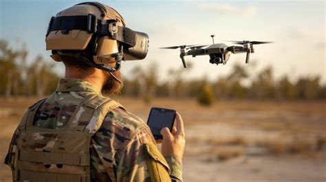
Flight Skills, FPV, and the Challenge of Control
FPV (first-person view) flying delivers immersive control but demands extensive training. Mastering acro mode—which lacks automatic stabilization—can take months. In contrast, Ardupilot platforms offer assisted modes, bridging the gap between ease and precision.
Operators must consider:
- Time to proficiency
- Environmental effects (wind, terrain, interference)
- Fallback modes in case of GPS or signal loss
In tactical settings, simplicity often trumps performance. This explains the continued popularity of stabilized GPS drones among amateur recon teams, despite their telemetry risks.
Strategic Recommendations for Drone Deployment
No platform is perfect. Each use case requires balancing reliability, stealth, cost, and legal exposure. That said, several key principles emerge:
- Avoid DJI or Chinese-built drones for tactical use, unless modified to disable telemetry and geofencing.
- Use open-source platforms (e.g., Ardupilot) for offline operations, customization, and full telemetry control.
- Train operators in manual and semi-automated flight modes, and rehearse missions in safe zones before live deployment.
- Consider Skydio or Parrot Anafi for U.S.-based manufacturing and reduced data exposure.
- Keep flights short, planned, and from cover to minimize detection risk.
- Develop or acquire basic counter-UAS tools like passive RF scanners or software-defined radios to detect hostile drones.
Conclusion: The Sky Isn’t the Limit—It’s the Frontline
Small man-portable drones have transformed tactical reconnaissance from a resource-heavy affair to a pocket-sized capability. They empower irregular forces, small units, and even individual civilians with bird’s-eye intelligence. But their use comes with caveats: hostile jamming, legal limitations, telemetry risks, and exposure to sophisticated detection.
To harness their full potential, users must adopt a layered approach: choose the right hardware, disable unwanted data paths, train with intent, and prepare for adversary responses. In the end, the battlefield of the future will be mapped and contested not just in trenches and towers—but in airspace inches above the tree line.


