
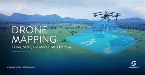
In today’s world, drone mapping software has become an indispensable tool for a wide range of industries, transforming the way professionals collect data, analyze landscapes, and make decisions. Whether it’s for agriculture, real estate, construction, or environmental conservation, drone mapping offers a fast, safe, and highly efficient method to gather vast amounts of data with precision. This technology not only provides crucial insights but also saves time and resources, making it an invaluable asset in modern workflows.
The Role of Drone Mapping Software in Modern Industries
Drone mapping software is more than just a tool for creating maps. It enables detailed, accurate, and real-time data collection, which allows professionals in various sectors to make informed decisions. The software is used to generate orthomosaics, digital elevation models (DEMs), point clouds, and 3D models from drone-captured imagery, facilitating analysis in ways that were once too expensive or labor-intensive. Whether farmers are monitoring crop health, construction managers are tracking project progress, or environmental scientists are studying ecosystem changes, drone mapping helps professionals achieve their goals more efficiently.
Key Features of Top Drone Mapping Software
When selecting drone mapping software, several factors should be considered to ensure it aligns with specific needs. The core features that define excellent drone mapping software include:
- Usability: A user-friendly interface that simplifies tasks like flight planning, data collection, and analysis is essential. The software should cater to both novice and experienced users.
- Output Quality: The generated data must be highly accurate to ensure reliable results. This includes the ability to produce high-resolution orthomosaics, DEMs, point clouds, and 3D models that can be used for detailed analysis.
- Efficiency: The software should process data swiftly, employing advanced algorithms to minimize errors and reduce processing times. It should also support multi-core processing and parallel computing for larger datasets.
- Automation: Features such as batch processing and workflow templates can save significant time by automating repetitive tasks.
- Integration: Seamless integration with Geographic Information Systems (GIS), Computer-Aided Design (CAD), and other industry tools is vital to ensure smooth data exchange and analysis.
- Quality Control and Validation: The ability to verify data accuracy through tools that check for errors, inconsistencies, and geometric precision is essential to ensure the reliability of the generated outputs.
With these features in mind, several drone mapping software solutions stand out in 2024 for their capabilities and versatility.
Leading Drone Mapping Software in 2025
In 2024, several drone mapping platforms lead the pack with their specialized features and diverse applications. These top software solutions cater to a variety of industries, offering a broad spectrum of capabilities ranging from photogrammetry to LiDAR integration. Below are some of the best options available today:
1. Pix4Dmatic: Speed, Scalability, and Precision
Pix4Dmatic is known for its exceptional speed and scalability, making it ideal for handling large datasets in complex aerial mapping projects. Designed specifically for LiDAR and photogrammetry workflows, Pix4Dmatic excels in processing high-resolution data quickly, which is critical for time-sensitive projects such as construction and surveying. By leveraging multi-core processing and distributed computing, Pix4Dmatic can significantly reduce data processing times while maintaining high accuracy.
A key feature of Pix4Dmatic is its batch processing capability, allowing users to process large volumes of drone-captured imagery in a single operation. This feature streamlines workflows, particularly for large-scale surveying and construction site monitoring. Additionally, its integration with Pix4Dsurvey ensures that processed data can be seamlessly exported for further analysis and CAD-ready use.
2. DJI Terra: Versatility and Integration
DJI Terra is a powerful drone mapping software designed specifically for integration with DJI drones. It offers comprehensive tools for generating 3D models, volumetric analysis, and terrain mapping. This software is particularly useful for industries that rely on drone-based surveying, agriculture, and construction. One of its standout features is its ability to work with different types of sensors, including LiDAR, thermal, and multispectral cameras.
The software’s ease of use and seamless integration with DJI’s drone fleet makes it an excellent choice for those who already use DJI products. DJI Terra also offers AI-powered optimization for water surface modeling, making it ideal for projects that require high-resolution surface analysis. With its flexible output formats and customizable tools, it caters to a wide range of industries.
3. Trendspek: Precision Reality Twins for Asset Management
Trendspek is transforming the way businesses manage and visualize their assets through the use of Precision Reality Twins. This technology creates highly detailed and accurate virtual representations of physical assets, allowing users to analyze and monitor asset conditions over time. Trendspek is particularly useful in industries like real estate, construction, and asset management.
One of the most notable features of Trendspek is its ability to process data quickly, cutting down render times from days to hours for even the most complex datasets. Additionally, it offers a cloud-based platform that enables teams from around the world to collaborate effectively on projects. Through shared annotations and in-model communication tools, Trendspek facilitates real-time discussions and decision-making, improving project efficiency.
4. Agisoft Metashape: Accuracy and Customization
Agisoft Metashape is a leading software in the field of photogrammetry, known for its accuracy and versatility in creating detailed 3D models and orthomosaics. It is widely used across industries such as archaeology, agriculture, and geospatial surveying due to its powerful processing capabilities. The software allows users to handle complex datasets, including those captured in challenging terrain conditions.
Agisoft Metashape provides customizable automation through its Python and Java API, allowing professionals to automate specific tasks or create custom workflows that suit their needs. This level of flexibility makes it ideal for professionals who need to incorporate drone mapping into larger, more complex workflows. Its precision and reliability in generating high-quality mapping outputs make it a go-to choice for demanding applications.
5. Bentley iTwin Capture Modeller: Geospatial Data Management for Infrastructure
Bentley iTwin Capture Modeller is a top-tier drone mapping solution designed specifically for infrastructure projects. Built on Bentley’s powerful iTwin platform, it provides a complete suite of tools for collecting, processing, and managing geospatial data. This software is particularly useful for projects involving large-scale infrastructure such as bridges, roads, and buildings.
The integration with the iTwin platform enhances project collaboration by offering advanced data management features, such as versioning and change tracking. Bentley iTwin Capture Modeller allows users to create highly accurate 3D models for infrastructure assets and supports real-time collaboration, making it a strong choice for teams working on complex infrastructure projects.
Choosing the Right Drone Mapping Software
Selecting the right drone mapping software depends heavily on the specific needs of the project. For example, those who focus on large-scale surveying or construction might prioritize speed and scalability, making Pix4Dmatic an ideal choice. On the other hand, users requiring advanced 3D modeling capabilities and asset management may find Trendspek to be the best fit. For industries that require comprehensive integration with DJI drones and sensors, DJI Terra is an excellent option.
Additionally, professionals looking for automation and customization options should consider software like Agisoft Metashape. It is crucial to evaluate both the technical features and ease of use of each software to ensure it meets the project’s specific requirements.
Conclusion
The future of drone mapping software is bright, with continual advancements in automation, speed, and accuracy. Whether you’re a professional in construction, agriculture, environmental science, or real estate, choosing the right software can significantly enhance your ability to collect and analyze data, making informed decisions easier and more efficient. As technology evolves, these software solutions are becoming increasingly accessible, offering powerful tools to make complex data analysis simpler and more effective. As you explore your options, make sure to select the software that aligns best with your needs to ensure maximum productivity and accurate results.

")


