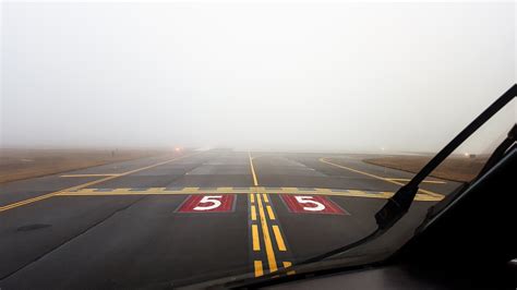
Fog remains one of the most persistent and hazardous weather phenomena in aviation and meteorology. Forming under specific atmospheric conditions, fog significantly reduces visibility, impacts air and ground travel, and plays a crucial role in weather forecasting. Despite its seemingly simple appearance, fog can arise through several complex mechanisms. In this article, we analyze the six primary types of fog, their formation processes, and their real-world implications—especially for aviators and meteorologists.
What is Fog and How Does it Form?
Fog is essentially a cloud at ground level, composed of tiny water droplets suspended in the air. It forms when the air becomes saturated, either by cooling to its dew point or by the addition of moisture. The dew-point spread—usually within 5°C or less—determines the likelihood of fog formation. Calm winds, high relative humidity, and clear skies are often the perfect setup.
There are two fundamental ways fog develops:
- Cooling of the air: When air temperature decreases to meet the dew point.
- Moisture addition: When water vapor increases in the air, raising the dew point to meet the ambient temperature.
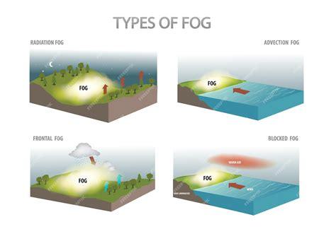
Depending on geographic location, time of day, wind patterns, and terrain, fog manifests in several distinct forms. Let us examine each type in detail.
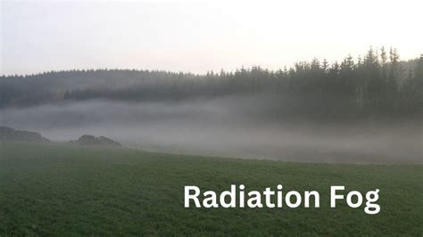
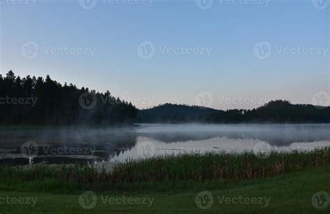
Radiation Fog: Calm, Cool, and Common
Radiation fog forms through radiative cooling of the Earth’s surface, typically under clear skies and light winds. As the ground cools overnight, it chills the adjacent air to its dew point, causing condensation and fog formation.
This fog is most commonly observed in the early morning hours, particularly in valleys or low-lying areas where cold air settles. With the sunrise, solar radiation heats the ground, often leading to dissipation by mid-morning.
Radiation fog is especially prevalent during autumn and winter, when long nights allow greater ground cooling. Its coverage is often shallow but dense, with visibility dropping below 1,000 meters, making it a significant hazard for morning commuters and early-morning flight operations.
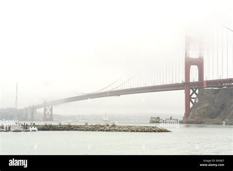
Advection Fog: Driven by Horizontal Movement
Unlike radiation fog, advection fog arises from horizontal movement of moist air over a cooler surface. This mechanism makes it persistent and widespread, often seen along coastlines where sea breezes transport oceanic air masses over cooler land.
In the Pacific Northwest, advection fog is almost a seasonal norm, frequently enveloping cities like San Francisco and Seattle. The Golden Gate Bridge, for instance, often appears partially submerged in this thick, slow-moving fog layer.
Because the air continues to be cooled over time and space, advection fog can linger for days, only dispersing with a significant change in wind direction or temperature.
Steam Fog: When Cold Air Meets Warm Water
Steam fog is a dramatic yet shallow type of fog that forms when cold, dry air moves over relatively warm bodies of water. As the warm water evaporates, it saturates the cold air above. Rapid condensation follows, creating fog that appears to rise like steam.
This fog is especially common during autumn and early winter, particularly over lakes, rivers, or even heated swimming pools in cold climates. For seaplane pilots, steam fog can present low-altitude operational challenges as it often hugs the surface but severely restricts visibility.
Steam fog also tends to be patchy and localized, unlike other fog types that stretch across regions. However, its sudden formation and intensity can surprise both aviators and motorists near large water bodies.
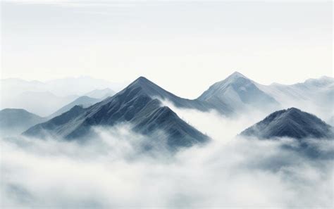
Upslope Fog: Geography-Induced Obstruction
Formed by airflow over rising terrain, upslope fog results when moist, stable air ascends a mountain or hill. As the air rises, it cools adiabatically and reaches saturation, leading to fog that can blanket highlands, ridgelines, and plateaus.
This type is particularly common along the eastern slopes of the Rocky Mountains, and can extend hundreds or even thousands of feet above the ground, depending on the elevation and wind speed.
Aviation-wise, upslope fog often triggers AIRMET Sierra advisories for IFR conditions in mountainous areas. It’s a persistent fog, maintained as long as the upslope flow continues. Forecasting its duration can be complex, especially when terrain plays a dominant role in local meteorology.
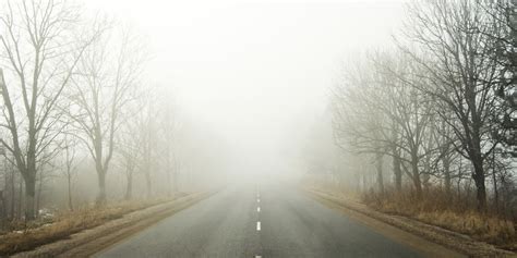
Precipitation Fog: Fog by Rainfall Saturation
Precipitation fog, also known as frontal fog, occurs when warm rain falls into cooler air near the surface. As the rain evaporates, it increases humidity to the point of saturation, producing fog that can be thick and long-lasting.
This type is most commonly associated with warm fronts, where warm, moist air overruns cooler surface air. It often develops ahead of or within a frontal system, especially when the rain is persistent.
From a pilot’s perspective, precipitation fog poses a challenge because it often coexists with actual rainfall, making it difficult to distinguish where fog ends and rain begins. Its persistence is directly tied to ongoing precipitation and temperature gradients.
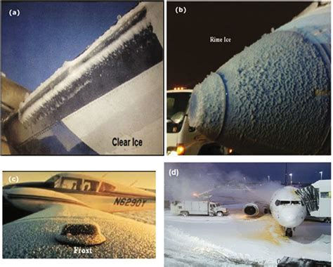
Freezing Fog: A Dangerous Icing Phenomenon
One of the most dangerous types of fog, freezing fog forms when supercooled water droplets exist in the air at temperatures below -9°C (15°F). Upon contact with surfaces—such as aircraft fuselages, power lines, or roads—these droplets instantly freeze, creating hazardous rime ice.
This fog typically appears in arctic and alpine regions, especially during long, cold nights. Its presence is extremely dangerous for aviation, particularly during takeoff and landing phases, when ice accretion can impair flight control surfaces and increase drag.
Freezing fog also poses major threats to ground infrastructure, leading to black ice on roads, damaged power grids, and hazardous walking conditions.
The Importance of Recognizing Fog Types
Understanding the distinct characteristics of fog types is essential not only for meteorologists but also for aviators, mariners, and motorists. Each form of fog poses unique challenges depending on its mechanism of formation, persistence, altitude, and spatial extent.
Pilots, especially those operating under VFR (Visual Flight Rules), must be able to interpret fog forecasts and recognize changing conditions to maintain safety. Meanwhile, weather agencies use this classification to issue more accurate visibility advisories.
In climate science, fog plays a critical role in ecosystem moisture cycles, particularly in fog-dependent forests and coastal zones where cloud forest ecosystems rely on regular condensation for survival.
FAQ
What is the difference between fog and mist?
Fog and mist are both formed from tiny water droplets suspended in the air. The key difference lies in visibility. Fog reduces visibility to less than 1 kilometer, while mist allows visibility between 1 and 2 kilometers. Fog is denser and more disruptive to travel.
Can fog form during the day?
Yes, while fog often forms at night or early morning due to cooling, certain types like advection fog or precipitation fog can form and persist throughout the day, especially when temperature and moisture conditions are stable.
How do pilots deal with fog during flights?
Pilots use instrument flight rules (IFR) to operate in foggy conditions, relying on cockpit instruments rather than visual cues. Airports may deploy ILS (Instrument Landing Systems), runway lights, and issue ATIS updates to ensure safe operations during low visibility caused by fog.


: A Comprehensive Guide")


