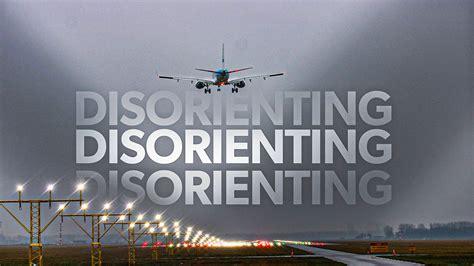
Night flying removes much of the visual information that pilots normally use to judge an approach. During daylight, the landscape provides a continuous three-dimensional reference: roads reveal direction and movement, buildings establish scale, hills define the horizon, and terrain texture helps the eye estimate distance. After sunset, those cues can disappear almost completely, particularly when an approach crosses open water or unlit terrain.
This is where night visual illusions become especially important. One of the best-known is the black hole effect, which can occur when an aircraft approaches a brightly illuminated runway over dark, featureless terrain or water. With little surrounding scenery to provide perspective, the runway lights can appear to sit higher in the pilot’s field of view than they really do. The aircraft may consequently be perceived as higher than it actually is, creating a tendency to descend below the intended glidepath.
Other airports present a different problem. Instead of removing visual information, their surroundings provide too many competing lights. Hillside neighborhoods can resemble a horizon, coastal roads can appear to be runway edges, and isolated lights at different elevations can make it difficult to establish a reliable sense of attitude and altitude. Mountains add another layer of risk because terrain that is obvious in daylight may become almost completely invisible at night.
The five airports below illustrate several versions of these problems. None is inherently unsafe when operated according to its published procedures and crew requirements. The issue is that night approaches can dramatically change the visual environment, making disciplined instrument flying and local knowledge particularly important.
Daniel K. Inouye International Airport: The Black Hole Effect Over the Pacific

Daniel K. Inouye International Airport presents one of the clearest examples of why an overwater approach can become visually deceptive after dark. Honolulu sits on the southern coast of Oahu, and several arrival paths involve substantial amounts of water before the aircraft reaches the runway environment. On a clear afternoon, the Pacific, coastline, mountains, buildings, and roads create an enormous amount of visual information. A moonless night is an entirely different proposition.
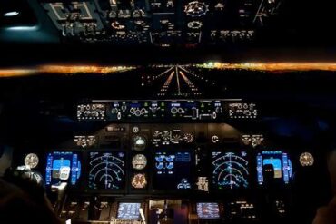
Long-haul flights arriving from the continental United States can spend hours crossing the Pacific before reaching Hawaii. During the final portion of an approach, there may be little or nothing visible beneath the aircraft other than a dark ocean. If cloud cover or haze removes the stars and moonlight, the boundary between the sky and sea can become extremely difficult to identify. The runway lighting then becomes the dominant visual reference, appearing almost isolated in the darkness.
This is the classic black hole approach illusion. The absence of peripheral references can make the runway appear higher relative to the aircraft than it really is. A pilot who relies too heavily on that visual impression may perceive the aircraft as being above the proper descent path and inadvertently fly lower. The danger is particularly significant because the visual impression can feel convincing even when it is wrong.
Honolulu’s multiple runways and coastal location mean that the precise visual environment depends on the runway and approach in use. The reef runway, for example, emphasizes the airport’s relationship with surrounding water. Other approaches may involve Ke’ehi Lagoon or coastal areas where urban lighting eventually becomes visible. Until those references appear, however, the runway lights can seem to float in an otherwise empty landscape.
The principal defense is to maintain confidence in instrument guidance rather than allowing the outside visual picture to override it. An ILS or other published instrument procedure provides an objective lateral and vertical reference. PAPI systems can reinforce the correct visual glidepath near the runway, but they do not replace the importance of established instrument guidance when the surrounding environment offers few reliable visual cues.
Nice Côte d’Azur Airport: Hillside Lights and a False Horizon
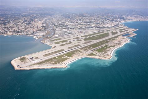
Nice Côte d’Azur Airport creates a particularly interesting night-approach environment because it combines an overwater approach with a densely illuminated mountainous cityscape. The airport occupies reclaimed land along the Mediterranean coast, and approaches toward Runways 04L and 04R can cross several miles of water before reaching the airport.
During daylight, there is little mystery about the geography. The Mediterranean provides a clear reference, while Nice’s coastline, buildings, roads, and rising terrain establish the relationship between the airport and the surrounding landscape. At night, however, the water becomes a dark expanse while the city becomes an intricate collection of lights.
The geography of Nice is particularly relevant because the city rises rapidly away from the coast. Residential neighborhoods and other development extend into the foothills of the Alpes-Maritimes, placing thousands of lights at elevations substantially above sea level. Those lights can create what is effectively a false horizon.
A natural horizon provides the visual system with an important reference for determining aircraft attitude. When the real horizon is difficult to see, the eye can unconsciously substitute another line or concentration of lights. At Nice, illuminated hillsides can form a visual boundary that looks convincing enough to influence the pilot’s perception of the aircraft’s pitch and altitude.
The problem is not simply that the city is bright. It is that the lights have geographical structure. They are not scattered randomly across a flat plain; they climb the surrounding terrain. That means the visual scene can contain a strong implied slope even though the actual horizon is somewhere else.
This creates an unusual combination. An aircraft approaching from over the Mediterranean may initially encounter a black-hole-type environment because the water provides little visual texture. As the airport and city become visible, the pilot suddenly encounters a large field of urban lighting that can itself be misleading.
Instrument approaches provide a way to separate perception from measurable flight-path information. Following the published localizer and glideslope, while using runway lighting and PAPI information appropriately, prevents an appealing but potentially inaccurate visual picture from becoming the primary source of vertical guidance.
Cristiano Ronaldo International Airport: Madeira’s Mountains Disappear at Night
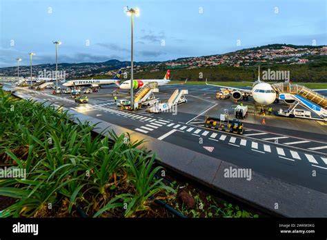
Cristiano Ronaldo International Airport is famous for its spectacular runway, much of which is constructed on a large platform supported by columns above the Atlantic coastline. The dramatic setting is visually impressive during daylight, but it also explains why night operations demand specialized procedures and experience.
Madeira is mountainous enough that terrain is a central consideration in almost every approach discussion. The island rises sharply away from the coast, with high ground surrounding the airport to the northwest. During daylight, those mountains provide an unmistakable visual warning of the geography. At night, they can effectively vanish into the darkness.
The airport’s Runway 05 approach is particularly distinctive because of the curved visual maneuver required to align the aircraft with the runway while remaining clear of terrain. Runway 23 has an offset final approach course for terrain-related reasons. These procedures mean that the relationship between the aircraft, runway and surrounding geography is unusually important.
After sunset, the Atlantic below can become a featureless black surface while the mountains surrounding the airport lose their visual definition. The pilot may therefore be required to execute a maneuver whose geographical purpose is obvious during daylight but whose terrain boundaries are much harder to perceive at night.
That is why Funchal’s night-operation requirements place significant emphasis on previous airport experience. Captains operating there after dark must have appropriate daytime experience at the airport, while the airport also has specific qualification and recency requirements. Airlines require authorization to conduct operations there, reflecting the specialized nature of the environment.
The important point is that Madeira’s difficulty does not come from one simple optical illusion. It is the interaction of several factors: high terrain, open ocean, a distinctive runway geometry, and reduced nighttime visibility of the surrounding landscape. The runway itself may be brilliantly illuminated while the terrain that defines the safe path around it is barely visible.
That contrast can be psychologically deceptive. The runway looks tangible and close, while the hazards are effectively hidden. A pilot cannot simply look outside and reconstruct the entire daytime geography from the available lights. The airport’s procedures and crew qualification requirements therefore become essential parts of the approach.
Juneau International Airport: Mountains Hidden Beyond the Runway
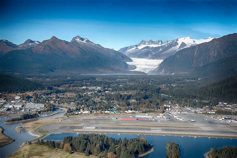
Juneau International Airport presents a different kind of nighttime challenge. Here, the issue is not primarily a runway appearing isolated over a flat ocean. Instead, the airport is located in a constrained mountain environment where the terrain can become nearly invisible precisely when it matters most.
Juneau lies in the Alaska Panhandle, surrounded by mountains and close to the Gastineau Channel. Peaks around the airport rise thousands of feet above the surrounding landscape. During daylight, these mountains are obvious. They provide pilots with a strong visual understanding of the valley’s shape and the physical boundaries within which the aircraft must operate.
At night, that geography becomes much harder to perceive. A mountain does not need to be hidden by clouds to disappear from a pilot’s visual field. Against a dark sky, an unlit mountain can simply become an indistinguishable mass of darkness. The channel below provides little additional assistance because water also becomes visually featureless after sunset.
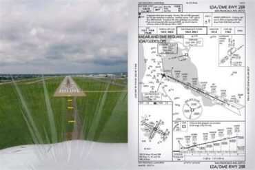
This makes instrument procedure discipline particularly important at Juneau. Published approaches use defined courses, altitudes and fixes to guide aircraft through terrain-constrained airspace. Step-down procedures allow aircraft to descend in controlled stages rather than relying on a pilot’s visual impression of where the ground is.
The missed approach is equally important. In a mountainous environment, simply climbing straight ahead is not necessarily an adequate escape strategy. Published missed approach procedures are designed around the surrounding terrain, providing a predetermined path away from hazards that may not be visible from the cockpit.
Juneau therefore illustrates one of the most consequential differences between an overwater black-hole approach and a mountain approach. At Honolulu, a pilot who develops an inaccurate visual impression may be descending toward water. At Juneau, a similar deviation can place the aircraft closer to mountain terrain that the crew cannot see.
The airport demonstrates why visual flying and instrument flying are not interchangeable skills. A mountain valley can look straightforward in daylight because the terrain effectively explains the navigation problem to the pilot. At night, the instruments have to provide that explanation instead.
Santos Dumont Airport: Rio’s Mountains Become a Maze of Lights
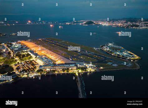
Santos Dumont Airport offers perhaps the most visually complicated environment of the five. The airport is located beside Guanabara Bay in central Rio de Janeiro, with prominent mountains and densely developed hillsides surrounding the approach environment.
Sugarloaf Mountain rises prominently near the airport, while Corcovado and other ridges form additional terrain references around the bay. In daylight, these landmarks are unmistakable. A pilot can see the shape of the bay, recognize the mountains and understand how the runway fits into the surrounding geography.
At night, the mountains themselves can become little more than dark silhouettes. Meanwhile, the city remains highly illuminated. That creates an unusual inversion in which the natural objects that explain the geography disappear while artificial lights remain highly visible.
An approach across Guanabara Bay can therefore present a dark-water environment followed by a complex urban landscape. Lights on the opposite shore, hillside neighborhoods, roads and buildings may all appear at different elevations. Some are close to the aircraft, others are much farther away. Without a clearly visible natural horizon, the eye has to construct a three-dimensional picture from these individual points of light.
That is a difficult task because light intensity does not reliably communicate distance or altitude. A bright light farther away can appear more prominent than a dim light that is much closer. A line of hillside houses can look like a horizontal reference even though it follows rising terrain. Road lighting can create additional lines that have nothing to do with the aircraft’s actual flight path.
Santos Dumont’s setting makes the airport a useful example of a different type of night visual problem: information overload rather than information deprivation. Honolulu can leave the pilot with almost nothing to interpret. Rio can leave the pilot with too many unrelated visual references competing for attention.
The solution is again to establish a reliable hierarchy of references. Published instrument guidance, runway lighting and appropriate visual approach cues have defined purposes. City lights do not. They may help provide situational awareness, but they should not be allowed to replace the flight-path information provided by the approach procedure.
Why Night Approaches Change the Pilot’s Visual Picture
These five airports demonstrate that nighttime approach hazards are not necessarily caused by poor visibility. In several cases, visibility can be excellent while the visual information itself remains misleading. A perfectly clear night over the Pacific can be more deceptive than a slightly hazy afternoon because the essential visual references have disappeared.
The black hole effect is particularly important because it exploits the way humans interpret visual perspective. When runway lights are surrounded by darkness, the brain has fewer reference points with which to establish distance and altitude. The runway can therefore appear higher than it really is, encouraging a descent that is lower than the actual glidepath.
False horizons work differently. Instead of removing information, they substitute misleading information. Hillside lights at Nice or the scattered illumination surrounding Guanabara Bay can provide an artificial reference that feels natural because it resembles the kind of horizontal structure the brain expects to see.
Mountain airports add a further complication. A pilot may know intellectually that a mountain exists and still be unable to see it at night. Knowing where terrain is and being able to visually perceive terrain are two very different things. Published instrument procedures bridge that gap by converting invisible geography into measurable courses, altitudes and protected flight paths.
That is ultimately why the most important feature of a difficult night approach is not how dramatic the airport looks from the cockpit. It is whether the crew can maintain a reliable, objective understanding of the aircraft’s position when the outside world becomes ambiguous.
At Honolulu, that may mean resisting the black-hole illusion over dark water. At Nice, it means recognizing that hillside lights are not a natural horizon. At Madeira, it means respecting a terrain-constrained visual procedure when the terrain itself has disappeared. At Juneau, it means treating instrument guidance as the primary protection from invisible mountains. At Santos Dumont, it means filtering an overwhelming urban lightscape rather than allowing it to become an unreliable navigation reference.
These airports show why night approaches are not simply daytime approaches with less sunlight. Darkness can remove the visual information pilots normally depend on, replace it with deceptive cues, or conceal hazards that are plainly visible during the day. The safest response is not to trust the most convincing picture outside the windshield, but to understand the specific illusion involved and maintain the published approach guidance that was designed for the airport’s geography.