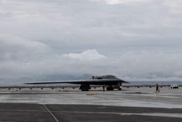
Flying to a remote island can look deceptively simple on a route map. An aircraft departs from a major city, crosses a large stretch of ocean, and eventually arrives at a runway surrounded by little else. For passengers, the journey may feel like a straightforward long-distance flight. For pilots and dispatchers, however, the same route can require an entirely different approach to fuel planning, because the usual network of nearby airports available during an emergency simply does not exist.
On a conventional flight, fuel planning is built around several layers of protection. An aircraft must carry enough fuel to reach its destination, account for expected contingencies, fly to an alternate airport when required, and retain a final reserve. When the destination itself is extremely isolated, that calculation becomes much more complicated. A runway that appears reasonably close on a map may not be usable as an alternate because of its runway, weather, operating hours, aircraft type, regulatory restrictions, or access requirements.
European Union Aviation Safety Agency rules illustrate how aviation authorities approach the problem. Under EASA’s March 2026 Easy Access Rules, an aerodrome can be treated as an isolated aerodrome when the fuel needed to reach the nearest adequate destination alternate, including final reserve fuel, exceeds the specified threshold. For turbine-powered aircraft, that threshold is two hours of normal cruise consumption above the destination, including the final reserve. EASA notes that the two-hour figure incorporates a 30-minute final reserve, leaving approximately 90 minutes for holding over the destination.
That does not mean every remote airport discussed here is formally designated as an isolated aerodrome under EASA’s rules. Different countries and operators use their own regulations and procedures, while aircraft performance, weather, available alternates and route structure all affect the final fuel calculation. These six airports are better understood as examples of places where geographic isolation makes destination fuel planning unusually important.
6. Norfolk Island Airport: A Remote South Pacific Destination
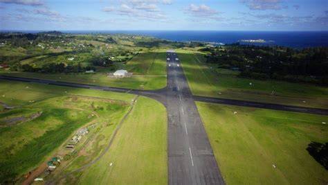
Norfolk Island Airport (NLK) serves Norfolk Island, an Australian territory in the South Pacific located far from the dense network of airports found along Australia’s eastern coast. The Australian Department of Infrastructure places the island approximately 994 miles (1,600 kilometers) northeast of Sydney, 553 miles (890 kilometers) northeast of Lord Howe Island and 684 miles (1,100 kilometers) northwest of Auckland. Regular passenger services connect the island with destinations including Sydney and Brisbane.
Those distances immediately change the way an airline must think about fuel. On a short mainland flight, an aircraft may have numerous airports within practical diversion range. A flight approaching Norfolk Island has dramatically fewer possibilities. Distance alone, however, does not determine whether an airport is a suitable alternate. Dispatchers must also consider runway characteristics, forecast and actual weather, airport operating conditions, aircraft performance and the operator’s approved procedures.
Australia has specifically recognized the additional challenges associated with remote-island operations. An Australian Transport Safety Bureau investigation into fuel planning examined flights involving designated remote islands, including Norfolk Island, Lord Howe Island and Christmas Island. Procedures documented by the ATSB included requirements for remote-island flights to carry an alternate and for isolated-aerodrome operations to carry fuel for two hours after arriving overhead the aerodrome, including fixed reserve fuel.
The important lesson from Norfolk Island is that “extra fuel” is not simply an arbitrary quantity added to every flight. It comes from a structured assessment of what happens if the planned landing becomes impossible. The farther an aircraft travels beyond the point where another airport can realistically be reached, the more important it becomes to know exactly how much fuel is available for holding, another approach, or an unexpected deterioration in conditions.
5. Christmas Island Airport: Thousands of Kilometers From Australia
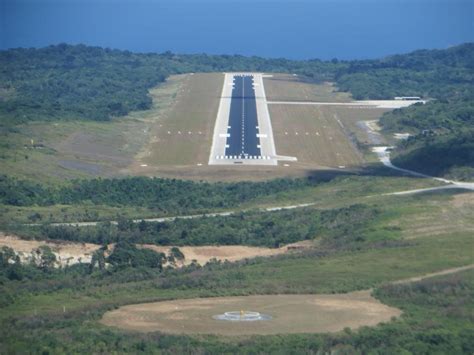
Christmas Island Airport (XCH) presents a similar challenge on the opposite side of Australia. The Australian Department of Infrastructure places Christmas Island approximately 1,616 miles (2,600 kilometers) northwest of Perth and only around 304 miles (490 kilometers) southwest of Jakarta. The island therefore sits much closer to Indonesia geographically than to Australia’s mainland airport network.
That creates an interesting distinction between geographical proximity and operational availability. An airport can be hundreds of miles closer than another potential diversion field and still be unsuitable for a particular flight. International borders, airport operating arrangements, weather, runway characteristics, aircraft capabilities and regulatory requirements all matter when a dispatcher determines whether an alternate is genuinely usable.
The Australian government supports air connectivity to Christmas Island because of its remote location, making the airport particularly important to the territory. Yet the very geography that makes scheduled air service necessary also makes operational planning more demanding. If an aircraft encounters a problem after departing the mainland, there are few conventional alternatives spread across the route in the way there would be on a flight crossing a densely populated region.
This is where the concept of a point of no return becomes especially important. Once an aircraft passes a particular point, returning to its departure airport may no longer be practical while satisfying all required fuel reserves. At an isolated destination, the flight plan therefore has to anticipate what happens after that point rather than assuming that another airport will always be available.
4. Cocos (Keeling) Islands Airport: A Remote Runway in the Indian Ocean
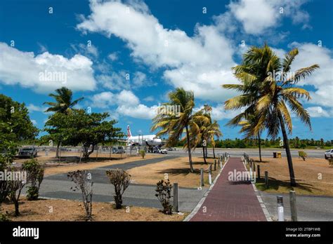
The Cocos (Keeling) Islands Airport (CCK) is another Australian external-territory airport where geography dominates flight planning. The islands are approximately 1,821 miles (2,930 kilometers) northwest of Perth and around 789 miles (1,270 kilometers) southwest of Jakarta. From the perspective of Australia’s main population centers, Cocos is separated by an enormous expanse of ocean.
The airport provides an essential connection for a territory that cannot rely on a dense road or airport network for access to the outside world. Its scheduled air links are therefore important not only for passengers but also for the movement of supplies and maintaining a connection with mainland Australia.
Cocos and Christmas Island may both have airports, but that does not mean either can automatically serve as the other’s alternate for every operation. An alternate airport has to be operationally suitable, not merely visible on a navigation chart. The aircraft must be capable of landing there, the runway and facilities must satisfy applicable requirements, and weather and other operational conditions must remain within the required limits.
The ATSB’s work on remote-island fuel planning highlights why these distinctions matter. Australian procedures have addressed the special risks associated with remote islands and isolated aerodromes, including situations in which additional fuel is required after the aircraft reaches the destination area. For passengers, the result may simply be a flight that carries more fuel than expected. Behind that decision is a detailed calculation designed to preserve options when there are very few options available.
3. St. Helena Airport: Isolation, Wind Shear and a Difficult Diversion Environment

St Helena Airport (HLE) is one of the most striking examples of an isolated airport serving scheduled commercial aviation. The airport opened in 2016, with commercial flights beginning in October 2017. St Helena itself is famous for its extraordinary remoteness in the South Atlantic and its historical association with Napoleon, who was exiled on the island.
Geography is only part of the operational challenge. The St Helena Government notes that the airport’s isolation and potential wind shear have resulted in its classification as a Category C airport, bringing additional considerations for approach, landing and takeoff. That means pilots have to account not only for the enormous distance separating St Helena from other airports but also for local conditions that can complicate an arrival.
Airlink operates flights between St Helena and Johannesburg’s OR Tambo International Airport, while flights to Ascension Island operate approximately once every four weeks, with additional services sometimes scheduled. Ascension is geographically significant because it is one of the few inhabited locations within the wider South Atlantic region that has an airport.
But even a relatively nearby runway cannot automatically be treated as a normal alternate. Wideawake Airfield on Ascension Island has a restricted operational status, and its availability is governed by specific arrangements. Consequently, the mere existence of another runway hundreds of miles away does not eliminate the need for careful isolated-destination fuel planning.
St Helena demonstrates a fundamental principle of aviation: the useful question is not simply, “Where is the nearest airport?” The more important question is, “Where can this aircraft legally and safely land if the planned landing cannot happen?” Those questions can produce very different answers.
2. Wideawake Airfield: A Military Runway With Limited Commercial Access
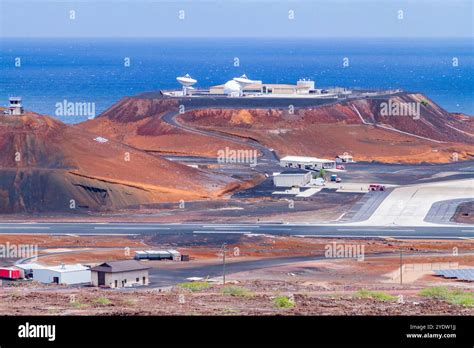
Wideawake Airfield (ASI) sits on Ascension Island in the South Atlantic, approximately 808 miles (1,300 kilometers) northwest of St Helena. On a conventional map, that makes it an obvious reference point for aircraft operating between the two isolated islands. Operationally, however, its status is far more complicated.
The United States Air Force and Royal Air Force jointly operate Wideawake. According to the Ascension Island Government, only state aircraft are generally authorized to land there, while commercial and privately operated aircraft are excluded except in emergencies. The scheduled St Helena–Ascension service operates under a specific exception.
This distinction is critical to understanding how fuel reserves for isolated airports work. A dispatcher cannot simply identify the nearest runway and count its distance as though it were an unrestricted commercial airport. If access depends on special authorization, the airport may not satisfy the requirements for an ordinary alternate.
For an aircraft approaching St Helena, Wideawake’s physical proximity is therefore only one part of the equation. The operator must consider whether the airport can actually be used under the circumstances, whether the aircraft is permitted to land, and whether the airport’s operational conditions meet the requirements of the flight plan.
That is precisely why isolated-aerodrome procedures place such importance on the point of no return. Once an aircraft passes that point, continuing toward the isolated destination is permitted only under defined conditions, with sufficient fuel and appropriate confidence that a safe landing can be achieved.
1. Mataveri International Airport: Rapa Nui’s Extraordinary Pacific Isolation

Mataveri International Airport (IPC) on Easter Island, or Rapa Nui, is perhaps the clearest example of extreme geographic isolation among these six airports. Chile’s Directorate General of Civil Aeronautics places the airport approximately 2,339 miles (3,762 kilometers) from Santiago’s Arturo Merino Benítez International Airport and describes Mataveri as the world’s most remote airport.
The scale of that separation changes everything about the surrounding aviation environment. A flight from Santiago to Rapa Nui crosses thousands of miles of Pacific Ocean, with very few practical alternatives along the way. On a continental route, a diversion may involve turning toward another major airport or landing at a nearby regional field. Approaching Mataveri, the safety net is dramatically thinner.
The airport’s traffic procedures reflect that unusual environment. According to Navigraph, Chilean authorities impose procedures under which only one aircraft can operate in the airport’s vicinity at a given time. Once an aircraft has passed the halfway point toward Mataveri, another aircraft cannot proceed beyond its own halfway point until the first aircraft has safely landed. Such procedures illustrate how an isolated airport can require special measures beyond conventional flight planning.
The fuel calculation is equally important. When an isolated-aerodrome scheme applies, the flight plan establishes a point of no return, after which the aircraft continues only when conditions indicate that a safe landing can be made. The aircraft must have enough fuel to maintain the required margins even though there may be no conventional alternate airport within easy reach.
For passengers, very little of this complexity is visible. The flight simply appears as a long transpacific journey ending at a remote island runway. Behind that ordinary arrival, however, pilots and dispatchers have planned around the possibility that the normal chain of alternatives is missing.
Why Remote Airports Require More Than a Simple Fuel Calculation
These six airports reveal why isolated airport fuel requirements are fundamentally different from the fuel planning associated with an ordinary short-haul flight. The aircraft is not necessarily carrying extra fuel because the flight itself is unusually long. Instead, additional fuel can become necessary because the destination offers fewer realistic escape routes if something changes.
Weather is one of the biggest variables. A destination that looks perfectly suitable when the aircraft departs may experience worsening visibility, stronger winds, wind shear or other conditions before arrival. At a major hub, that deterioration may trigger a diversion to one of several nearby airports. At an isolated island, the same deterioration can leave the aircraft with dramatically fewer choices.
Airport accessibility is equally important. The nearest runway is not automatically the nearest suitable alternate. Military restrictions, customs and immigration requirements, runway limitations, airport operating hours and aircraft performance can all remove an apparently convenient option from the flight plan.
That is why fuel planning for remote destinations is best understood as an exercise in preserving choices. The aircraft may need fuel to hold, attempt another approach, proceed toward an alternate, or remain above the destination while conditions improve. In the most isolated environments, those reserves are not an unnecessary luxury. They are part of the operational safety margin that makes scheduled commercial service possible.
From Norfolk Island and Christmas Island to Cocos, St Helena, Ascension and Rapa Nui, the same principle appears in different forms. The farther an airport is from a practical alternative, the more carefully pilots and dispatchers must plan for the moment when the original plan stops working. The passenger may only see an isolated runway at the end of a long ocean crossing. Aviation professionals see something much more complicated: a destination where every kilogram of fuel can represent another layer of safety.