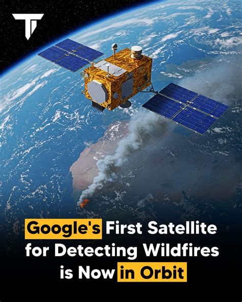
Wildfires are becoming faster, larger, and more destructive as rising temperatures, prolonged droughts, and changing weather patterns create conditions where small fires can rapidly transform into major emergencies. Traditional wildfire detection methods often rely on ground crews, aircraft patrols, or existing satellites that may not provide enough speed or precision during the earliest moments of a fire. A new generation of space technology is now changing that approach with FireSat, the first dedicated satellite constellation designed specifically to detect wildfires before they grow beyond control.
The FireSat satellite constellation represents a major shift in how humanity monitors one of the planet’s most dangerous natural threats. Instead of reacting after flames spread across thousands of acres, FireSat aims to identify small thermal signatures while fires are still manageable. By combining advanced infrared imaging, artificial intelligence, and a network of low-Earth-orbit satellites, the system could provide emergency responders with critical information much earlier than previous technologies.
Climate Change Is Driving the Need for Faster Wildfire Detection
Wildfires have always been part of natural ecosystems, but recent decades have seen a dramatic increase in their frequency, intensity, and duration. Rising global temperatures are drying forests, extending wildfire seasons, and creating landscapes where fires can spread with unprecedented speed. In regions such as western and northern North America, extreme wildfire events have become increasingly common, putting communities, wildlife habitats, and critical infrastructure at risk.
The wildfire season in many areas has also become significantly longer. In the western United States, for example, fire seasons are now more than a month longer than they were several decades ago. Higher nighttime temperatures are also reducing the natural cooling periods that once helped slow fire growth, allowing flames to remain active for longer periods.
The consequences extend far beyond burned landscapes. Wildfire smoke can travel hundreds or even thousands of miles, reducing air quality and increasing health risks. Forest destruction also contributes to biodiversity loss and releases large amounts of stored carbon into the atmosphere, creating a cycle that can worsen climate challenges.
FireSat Becomes the First Satellite System Designed Specifically for Wildfire Monitoring
Developed by Muon Space in partnership with the Earth Fire Alliance, FireSat is a specialized satellite network created from the ground up for wildfire detection. Unlike general-purpose Earth observation satellites, FireSat is optimized to identify the unique infrared signals produced by early-stage fires.
The constellation began operational deployment after the launch of its first satellites aboard SpaceX’s Transporter 17 mission on July 7, 2026. The system follows successful testing of a prototype satellite called Protoflight, which spent a year collecting more than one million multispectral infrared images from orbit.
During testing, Protoflight demonstrated the ability to detect real-world wildfire events, including a small roadside fire in Oregon that was missed by other monitoring systems. This achievement showed that specialized satellite technology could identify dangerous fires before conventional systems recognized the threat.
The project has attracted support from organizations including the Bezos Earth Fund, the Betty Moore Foundation, and Google. The long-term goal is to create a global early-warning system capable of reducing wildfire damage and helping save billions of dollars in economic losses.
How FireSat Satellites Detect Small Fires Through Smoke and Clouds
The operational FireSat satellites are based on the Condor-M spacecraft platform, a modular satellite design created for low-Earth-orbit missions. Each satellite carries a highly advanced multispectral infrared imaging system capable of observing six different infrared wavelength bands.
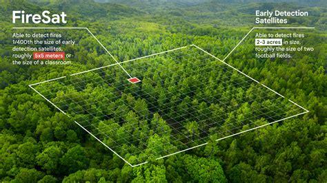
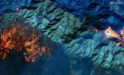
This technology allows FireSat to detect fires as small as approximately 16 square feet. More importantly, the system can identify heat signatures even when smoke or cloud cover blocks traditional visual observation. By analyzing multiple infrared signals, FireSat can distinguish actual fires from false alarms caused by sunlight reflections, industrial activity, or other heat sources.
Each satellite can scan a land area roughly 930 miles wide during a single pass. This broad coverage allows the constellation to monitor large portions of the planet while maintaining the sensitivity needed for early fire detection.
The satellites are supported by the Muon Halo platform, which provides real-time data processing capabilities. Artificial intelligence plays a central role by comparing new satellite images with thousands of previous observations from the same locations. The AI system evaluates environmental conditions, weather patterns, and historical data before deciding whether a detected thermal anomaly is likely to be an actual wildfire.
Artificial Intelligence Gives Firefighters Critical Time to Respond
The biggest advantage of FireSat is not simply seeing fires from space. The real breakthrough is reducing the time between fire ignition and emergency response.
A small fire can become a massive wildfire within hours under the right conditions. Early detection gives firefighters opportunities to deploy resources before flames spread into forests, residential areas, or critical infrastructure.
The current group of three operational satellites can scan fire-prone regions approximately twice per day. However, the planned full constellation of 50 satellites could dramatically increase monitoring frequency. Once completed, FireSat aims to capture images of every location on Earth roughly every 20 minutes, with higher-risk areas receiving even more frequent observation.
The Earth Fire Alliance and Muon Space are also targeting hourly monitoring of vulnerable areas by 2029. Such capability would represent a significant improvement over many existing wildfire detection systems.
FireSat Could Transform Global Wildfire Response
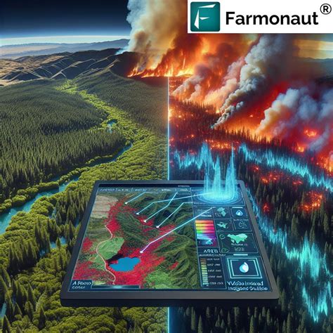
The impact of FireSat could extend far beyond improving satellite imagery. By providing early warnings, the system could help governments, firefighters, conservation groups, and communities make faster decisions during emergencies.
For firefighters, accurate information about a fire’s location, size, and growth pattern can improve safety and resource planning. For communities, earlier alerts could provide additional time for evacuation preparations. For environmental organizations, detailed wildfire data could improve efforts to protect forests and wildlife.
The technology will not eliminate wildfires, which remain a natural part of many ecosystems. However, FireSat could change how the world responds to them. Instead of discovering fires after they become major disasters, authorities may soon have the ability to intervene during the earliest stages.
As climate change continues to increase wildfire risks, innovative solutions like FireSat demonstrate how space technology and artificial intelligence can work together to protect lives, ecosystems, and communities. The constellation may become one of the most important tools in the global fight against increasingly severe wildfires.