Public safety drones have evolved from experimental tech to indispensable tools across police departments, fire services, emergency medical teams, and disaster response units. In 2025, they are more than just flying cameras—they are autonomous partners capable of delivering real-time intelligence, enhancing situational awareness, and saving lives. As the demand for rapid, risk-mitigated aerial response grows, public safety agencies are investing in sophisticated drones that meet stringent operational, technical, and legal requirements.
The Evolution of Public Safety Drones
Ten years ago, the idea of drones in public safety was novel—confined mostly to military applications or hobbyist communities. Fast forward to 2025, drones are embedded in daily operations of major metropolitan departments, small-town fire services, and federal response agencies. This transformation is not just a result of technological advances but also a response to escalating urban risks, climate-related disasters, and public demand for more responsive and transparent emergency services.
Public safety drones now range from autonomous search-and-rescue (SAR) units that sweep large terrain, to LiDAR-equipped mappers used for post-disaster damage assessments. Some agencies deploy fleets with task-specific units, from indoor tactical drones for hostage scenarios to thermal aerial scouts during wildfire suppression.
Best Public Safety Drones of 2025
Modern public safety drones blend optical superiority, durability, secure data systems, and flight resilience. Here are the top models defining 2025:
Skydio X2
A favorite among tactical teams, the Skydio X2 offers a 35-minute flight time, 4K60P HDR video, 16× digital zoom, and an infrared FLIR® Boson sensor (320×256 resolution) with 8× zoom. With 360° obstacle avoidance and 6–10 km range, it’s NDAA compliant and mission-ready in under 75 seconds. Ideal for search missions, building entries, or fast-moving events.
BRINC Lemur 2
Engineered for indoor law enforcement operations, the Lemur 2 boasts a 31-minute flight, night vision, two-way communication, and a patented glass-breaker blade. Fully encrypted, it’s designed for hostage scenarios, breach-and-clear missions, and emergency indoor navigation.
DJI Matrice 30
With a 41-minute runtime, 48 MP camera, 200× digital zoom, laser rangefinding, and optional 640×512 thermal imaging, the M30 is rugged (IP55 rating) and equipped for disaster mapping, urban surveillance, and wildfire reconnaissance. A three-propeller emergency landing mode adds unmatched reliability.
DJI Matrice 300 RTK
This platform leads with 55-minute flight time, triple payload support, and AES-256 encryption. Its H20T sensor suite includes a 20 MP zoom lens, 12 MP wide-angle, and 640×512 thermal camera, with a 15 km range. Built to weather storms (IP45), it’s favored for critical infrastructure inspections and nighttime SAR.
DJI Mavic 3T
Balancing portability and power, the Mavic 3T offers a dual visual/thermal sensor suite (48 MP, 640×512 radiometric), RTK readiness, 15 km transmission, and APAS 5.0 autonomous navigation. Its 45-minute flight and compact form make it a first-responder favorite.
Key Features to Look For in Public Safety Drones
Selecting the right drone isn’t just about specs—it’s about mission-critical functionality:
- High-resolution optical and thermal cameras for dual visibility in day and night.
- Low-latency, encrypted video streams that maintain data integrity over long distances.
- Minimum 30-minute flight time and ruggedized, field-swappable batteries.
- 360° obstacle avoidance, automated return-to-home, and geo-fencing.
- Two-way audio systems for loudspeaker announcements or negotiation.
- Weatherproof builds and self-righting mechanisms for unpredictable environments.
Launching a Public Safety Drone Program
Agencies planning to deploy drones must formalize infrastructure, from hardware acquisition to regulatory compliance.
Program Setup Essentials
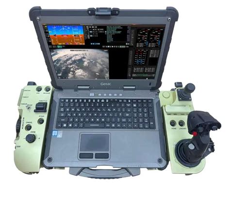
Start with drone and software selection—choose tools like Axon Air for real-time streaming or 3D mapping platforms for terrain analysis. Regulatory clearance is vital: decide between Part 107 (Remote Pilot Certificate) or COA (Certificate of Authorization) depending on your operational needs.
Pilot training should include FAA certification, minimum flight hours, and ongoing SOP (Standard Operating Procedure) refreshers. Build out support infrastructure—secure equipment storage, log training hours, define acquisition timelines.
Operational Workflow
- Planning: Define mission goals, terrain risks, and timing windows.
- Pre-flight Checks: Inspect systems, validate battery life, ensure firmware is updated.
- Execution: Capture live visuals or data, adjust flight path as needed.
- Analysis: Use both real-time and post-flight footage for actionable insight.
- Post-op Review: Debrief, archive footage, and document process improvements.
Understanding Legal Framework: Part 107 vs. COA
Choosing between FAA Part 107 and a COA determines your operational scope. Part 107 offers rapid deployment and requires a Remote Pilot Certificate, but restricts flying over people, at night, and beyond visual line of sight (BVLOS) without separate waivers.
A COA, on the other hand, opens doors for BVLOS operations, nighttime flight, and urban overflight—but requires detailed program documentation, system logs, and risk assessments. Many agencies begin with Part 107 for faster rollouts and apply for Targeted BVLOS (TBVLOS) waivers under COA for extended capability.
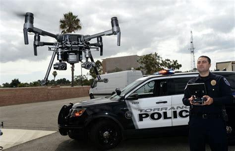
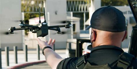
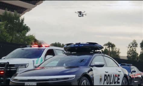
Drone as First Responder (DFR)
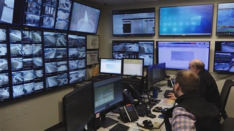
One of the most impactful developments in public safety is the Drone as First Responder model. In cities like Chula Vista, drones launch immediately after a 911 call, arriving often before human responders. Streaming real-time aerial footage, they give en-route teams crucial intel: suspect movement, fire progression, or hazardous materials detection.
The DFR model reduces response time, enhances team safety, and allows dispatchers to triage resources based on aerial insight—often preventing escalation or enabling life-saving interventions before the first boots hit the ground.
Use Cases Across Agencies
Public safety drones enable more than surveillance—they’re critical to response, prevention, documentation, and recovery across departments:
Disaster Response
From assessing damage post-earthquake to flood mapping and victim location, drones provide real-time topography and imagery. In haz-mat situations, they deliver sensor-based detection without risking human teams. Post-storm, drones facilitate supply drops and communications relays.
Emergency Medical Services (EMS)
Drones assist EMTs with scene visualization, delivery of medical kits, and remote patient assessments—especially in inaccessible locations. They streamline accident response by recording real-time feeds and delivering lab samples or antivenom kits in rural zones.
Fire Departments
Thermal drones spot hot zones, assess structure risk, and monitor controlled burns. Before wildfires strike, pre-mapping supports strategic planning. During incidents, drones aid in aerial water drops, emergency delivery, and investigation of arson scenes.
Law Enforcement
Police deploy drones for crowd surveillance, pursuit of suspects, and covert intelligence during active situations. They are also pivotal in wildlife protection patrols, environmental compliance monitoring, and traffic congestion analysis.
Search and Rescue (SAR)
Thermal-equipped drones can locate missing hikers in forests or avalanche zones, dropping supplies while coordinating ground teams. In floods, drones aid in swift-water rescues, navigating terrain often inaccessible by vehicle or foot.
Conclusion: From Eye in the Sky to Essential Lifeline
Drones in public safety have redefined operational speed, precision, and safety. They serve as aerial scouts, communication bridges, and incident documentarians. As tech advances further with AI-driven flight autonomy, object recognition, and edge processing, public safety drones will continue expanding their role—not just supporting responders but becoming the first responders themselves.
Agencies that invest now in the right hardware, software, and training are poised to deliver faster, safer, and smarter emergency services. The sky, quite literally, is no longer the limit—it’s the frontline.


