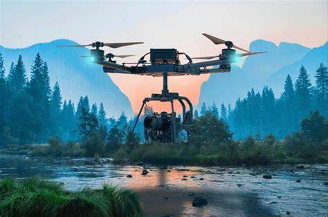
Drone technology in 2025 is more than a trend—it’s a revolution. The modern UAV (Unmanned Aerial Vehicle) ecosystem is an intricate web of cutting-edge hardware manufacturers, sophisticated software developers, and agile service providers. With applications spanning from defense and agriculture to entertainment and logistics, the global drone market is surging ahead. In this in-depth guide, we profile the top 29 drone companies dominating the industry in 2025, evaluated meticulously based on market share, innovation, product versatility, support, and operational excellence.
DJI: Unrivaled Leader in Consumer and Enterprise UAVs
Shenzhen-based DJI maintains its commanding presence with a staggering 74.3% market share, driven by a comprehensive catalog that caters to everyone from hobbyists to first responders. Flagships like the M30T for industrial use and the compact Mini 2 for consumers showcase DJI’s core strengths: superior camera quality, reliable obstacle avoidance, and robust flight stability.
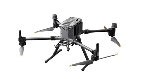
DJI’s enterprise line is deeply embedded in infrastructure inspection, search-and-rescue, and agricultural monitoring. The seamless integration with proprietary apps like DJI Pilot 2 and FlightHub 2 ensures precise mission control, analytics, and real-time collaboration.
Orqa: Innovating the FPV Frontier
Croatian pioneer Orqa continues to redefine the FPV (First-Person View) experience. Its advanced goggles are more than just immersive; they serve as command centers for drone pilots, supported by proprietary radio, optics, and edge computing innovations. By expanding into full-stack drone engineering, Orqa is shaping the future of piloted UAV sports and commercial inspections.
AeroVironment: The Tactical Powerhouse
AeroVironment, headquartered in California, stands as the backbone of UAV operations in defense sectors globally. Systems like the Puma 3AE and the loitering munition Switchblade are deployed by militaries for reconnaissance, target acquisition, and kinetic missions. With nearly five decades of aerospace heritage, AeroVironment offers unmatched battlefield resilience and real-time intelligence.
PowerVision: The Multidimensional Robotic Visionaries
China’s PowerVision has carved a niche by building hybrid-capable robots. Its flagship, the PowerEgg X, morphs between drone and AI-powered handheld camcorder, while the underwater PowerRay explores marine landscapes. These hybrid systems blur the line between aerial and aquatic, enabling unique mission profiles and consumer-grade creativity.
Parrot: The Secure Surveyor
French stalwart Parrot champions cybersecurity, a crucial feature in the modern drone landscape. Its ANAFI USA and ANAFI Thermal models are tailored for critical missions, boasting 32x zoom, thermal imaging, and secure data handling. Government agencies and infrastructure firms trust Parrot for its reliable, rugged, and GDPR-compliant UAV platforms.
Autel Robotics: Premium Imaging and Flight Time
Autel Robotics, with its roots in Shenzhen, continues to impress with the Evo Nano+ and Evo Lite+—drones capable of shooting 50MP stills and staying airborne for over 40 minutes. Their superior imaging, intuitive controls, and intelligent tracking modes cater to both media professionals and tactical users.
Skydio: Autonomy Redefined
Skydio, based in California, leads the wave of autonomous drone operations. The Skydio 2+ and enterprise-ready X2 navigate complex environments without GPS, thanks to AI-driven spatial awareness. Innovations like the Skydio Dock enable remote deployment and fleet automation—vital for inspection and defense missions.
Delair: Industrial Mapping with Precision
France’s Delair specializes in fixed-wing drones optimized for surveying and industrial inspection. Their UX11 and DT26X LiDAR models are mainstays in oil & gas, mining, and construction, capturing high-resolution orthophotos and point clouds at scale.
Ehang: Pioneers of Passenger Drones
Guangzhou-based Ehang leads in autonomous aerial vehicles (AAVs). The EHang 184 and cargo-grade 216L signal a paradigm shift in air mobility and urban logistics. As regulators catch up, Ehang is setting global benchmarks for certification and operational readiness in passenger drone aviation.
Freefly Systems: Cinematic Aerial Mastery
In the world of cinematography, Freefly’s Alta X is revered. Coupled with the Movi Carbon stabilizer, these systems deliver buttery smooth footage, even under turbulent conditions. Based in Washington, Freefly caters to the film industry’s elite and mission-critical visual storytellers.
Flyability: Navigating Confined Spaces
Switzerland’s Flyability has carved out a unique niche with the Elios 2, a collision-resistant drone built for indoor inspection. Power plants, sewer systems, and chemical facilities deploy Elios to access the inaccessible without endangering human lives.
Insitu: Military Intelligence from the Skies
As a Boeing subsidiary, Insitu designs drones like the ScanEagle and Integrator for extended ISR (Intelligence, Surveillance, and Reconnaissance) missions. These systems offer endurance, payload adaptability, and cross-platform compatibility—a trifecta for defense logistics.
Wingtra: Surveying with Vertical Agility
Zurich’s WingtraOne Gen II combines VTOL (Vertical Takeoff and Landing) agility with the range and endurance of fixed-wing flight. Industries rely on its centimeter-level accuracy and the WingtraCLOUD platform to digitize landscapes efficiently.
Airobotics: Autonomous Security and Agriculture Solutions
From Tel Aviv, Airobotics delivers fully autonomous drones capable of round-the-clock operation. The Iron Drone system excels in security, border patrol, and agricultural monitoring, thanks to its Drone-in-a-Box architecture.
JOUAV: Elevating Public Safety and Agriculture
China’s JOUAV offers a robust line of CW-series fixed-wing UAVs. Their exceptional stability and payload options make them invaluable in crop monitoring, disaster response, and large-area mapping.
Draganfly: Humanitarian and Tactical Innovation
Canada’s Draganfly balances humanitarian innovation with tactical features. The Draganflyer Commander 2 supports thermal imaging, autonomous pathfinding, and is often used in emergency response scenarios.
Brinc: Drones for Life-Saving Situations
Seattle-based Brinc is redefining public safety. Their drones feature two-way audio, allowing SWAT teams and rescue teams to negotiate or locate victims remotely, especially in active shooter and collapsed building situations.
Guardian Agriculture: Crop Protection from the Sky
Massachusetts’ Guardian SC1 is an eVTOL drone built for high-precision agricultural spraying. Entirely automated, it enables consistent, data-driven crop protection without pilot input, boosting yields and sustainability.
Leading Drone Software Innovators in 2025
While hardware soars, the real power of drones often lies in advanced software ecosystems.
Airspace Link: Airspace Made Accessible
Detroit’s Airspace Link simplifies regulatory compliance through AirHub, integrating LAANC approvals with real-time airspace mapping. It’s a vital backbone for commercial drone operations in urban zones.
AgEagle: Agri-Intelligence at Scale
Known for the eBee TAC, AgEagle captures high-resolution multispectral imagery to analyze crop health, irrigation needs, and pest stress—helping farmers optimize resources sustainably.
Trimble: Mapping Meets Precision
Colorado-based Trimble bridges GIS data with drone-derived models, delivering comprehensive site visibility. From land development to environmental analysis, Trimble’s UAV integrations set new standards in reality capture.
Bentley Systems: Infrastructure Modeling with Aerial Insight
With tools that turn drone imagery into actionable 3D infrastructure models, Bentley Systems is essential for utilities, highways, and smart cities managing assets efficiently.
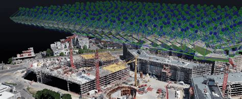
Pix4D: From Photos to Precision Models
Switzerland’s Pix4D remains a leader in photogrammetry, converting raw images into dense 3D reconstructions. Construction firms, surveyors, and emergency responders rely on Pix4Dmapper and Pix4Dcloud to visualize and share data.
DroneDeploy: Cloud-Powered Drone Operations
DroneDeploy’s strength lies in its cloud-based mapping and real-time analytics. Its drone-integration ecosystem spans construction, agriculture, and solar industries, providing insights from flight to finish.
Propeller Aero: Earthworks Made Easy
From Sydney, Propeller Aero helps contractors track earthworks, measure stockpiles, and manage projects with survey-grade maps that update continuously.
ESRI: Spatial Intelligence with UAV Synergy
ArcGIS, the cornerstone of spatial analytics, integrates drone data seamlessly, enabling governments and NGOs to monitor change, track assets, and plan interventions with UAV-derived insights.
Maps Made Easy: Simplicity in Photogrammetry
This intuitive platform offers web-based map stitching, 3D modeling, and volume measurement, ideal for small to mid-scale enterprises seeking precision without complexity.
VOTIX: BVLOS and Drone-in-a-Box Management
New York’s VOTIX powers fully autonomous drone networks, facilitating Beyond Visual Line of Sight (BVLOS) operations. It unifies fleet automation, live video, and compliance in a single pane.
AirData: Drone Fleet Health and Telemetry
Rounding out our list is AirData, a key player in fleet management, flight logging, and live telemetry. Operators worldwide use its platform to ensure drone safety, regulatory compliance, and performance monitoring.
Final Thoughts: Aerial Futures Defined by Innovation
From cinematic storytelling to critical infrastructure, the 29 companies spotlighted here are not just participants—they are architects of the drone future. In 2025, the lines between air, data, and mission success blur as these innovators reshape logistics, defense, public safety, and creative industries. Each is pushing boundaries, redefining what’s possible in the skies above us.


")

