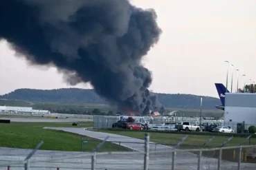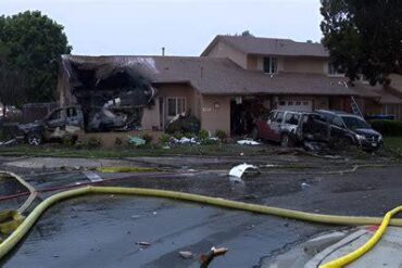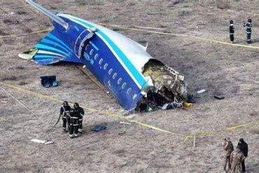
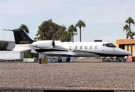
The Learjet 60 that broke apart over Florida on Sunday, killing all nine people aboard, had already shown unsettling behavior in turbulent air six months earlier. Resurfaced air traffic control audio from May 2026 captures the same aircraft, registered as N722BD, fighting to hold its assigned altitude near Newark Liberty International Airport (EWR), New Jersey, while a controller pushed back hard on the crew’s description of the conditions as merely moderate. That exchange, first reported by the Daily Express and drawn from audio obtained by The US Sun, has sharpened scrutiny of how the pilots characterized the weather they encountered on both flights. Investigators have not established any link between the two events, and the identities of the pilots in the May incident remain unconfirmed, including whether either was at the controls on the fatal flight.
Newark Controller Challenged the Crew’s Turbulence Report
During the May encounter, the business jet was climbing when it should have been holding steady, drawing the controller’s attention in crowded airspace. A female pilot replied that she was “just about to call you,” reported moderate turbulence, and admitted the aircraft could not maintain its cleared altitude. The controller did not accept that account. He ordered the crew down to 4,000 feet, conscious that another business jet was operating nearby at a similar level, a proximity that could quickly become a separation problem. A male pilot then repeated that N722BD was in moderate chop, but the controller held his ground, arguing that an aircraft incapable of holding altitude was facing something far worse than moderate conditions. “If you can’t maintain altitude, that’s not moderate. That’s severe turbulence,” he told the crew.
Asked directly whether they were in severe turbulence, both pilots answered in the affirmative. The female pilot reported no injuries but confirmed the severe conditions were persisting. The exchange lasted only minutes, yet it created a detailed record of an aircraft unable to do the one thing controllers rely on most: hold an assigned level.
The Altitude Data That Undercut the ‘Moderate’ Label
Flight data attached to the May recording shows N722BD swinging as much as 700 feet above and 400 feet below its assigned altitude of 4,000 feet. The Federal Aviation Administration’s turbulence scale reserves moderate for conditions that change altitude, attitude, and airspeed while pilots retain positive control of the aircraft. Severe turbulence brings larger and more abrupt shifts that can briefly leave an aircraft out of position, with extreme turbulence implying violent tossing that makes control practically impossible. A 700-foot excursion sits well outside the behavior the scale attributes to moderate chop.
For N722BD, the numbers lend weight to the controller’s reading. In congested terminal airspace, assigned altitudes are the backbone of separation, and an unplanned climb or descent can create a potential conflict even when the cause is weather rather than pilot error. Accurate reports help controllers warn following traffic and assign safer altitudes. Difficulty holding altitude alone does not prove a mechanical fault or a loss of control, and controllers are not investigators, but the May tape suggests the initial “moderate chop” call understated the difficulties aboard.
6 Months Later, a Similar Report Ended in Catastrophe
On Sunday, N722BD departed Austin-Bergstrom International Airport (AUS) bound for North Eleuthera Airport (ELH) in the Bahamas with seven passengers and two pilots. While crossing South Florida at 35,000 feet, the crew reported light clear icing and turbulence, with altitude deviations of roughly 600 to 700 feet. The echo of May is uncomfortable: again, pilots on the same airframe called the ride moderate while the aircraft wandered several hundred feet off its level. Those deviations alone do not prove the November conditions met the FAA’s severe threshold, and icing, the jet stream, and other factors may have contributed.
After entering precipitation, the crew asked to climb to 37,000 feet in search of smoother air. ATC approved, but less than 30 seconds later the pilots reported an uncontrolled descent and declared an emergency. Flightradar24 data indicates the Learjet’s descent rate exceeded 32,000 feet per minute before it crashed in Palm Beach County.

Debris Points to an In-Flight Breakup
The National Transportation Safety Board (NTSB) has already found evidence of an in-flight breakup. Pieces of the aircraft’s left elevator were recovered between 1.3 miles (2.1 km) and 3.8 miles (6.1 km) from the impact site, a scatter pattern consistent with the airframe failing in the air rather than on ground contact. Investigators are now working through weather data, aircraft systems, maintenance records, and flight communications. A preliminary report is expected within about 30 days, while the full investigation will take substantially longer. The May audio does not explain the disaster, and no causal connection has been established, but the two flights now share a troubling pattern: the same aircraft, the same altitude struggles, and the same initial hesitation to call turbulence severe.