In critical search and rescue (SAR) scenarios, time and precision define life-saving outcomes. Whether it’s navigating rugged mountains, sweeping vast rural expanses, or penetrating cave systems with no GPS signal, drones have transformed SAR operations by extending the eyes and ears of emergency responders. From their thermal imaging capabilities to their ability to map terrain in real time, the latest SAR drones are a technological leap in public safety infrastructure.
Modern SAR drones are not only flying cameras—they are aerial data hubs equipped with sensors, Lidar, GPS RTK, and even laser range finders. These tools are crucial in delivering actionable intelligence, especially during missions in inaccessible or hazardous environments. One drone stands above the rest in performance, versatility, and adoption among elite SAR teams worldwide.
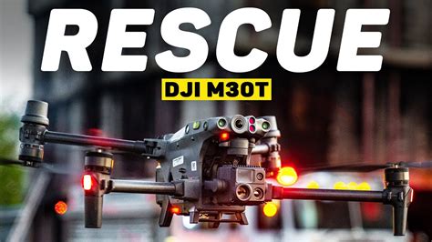
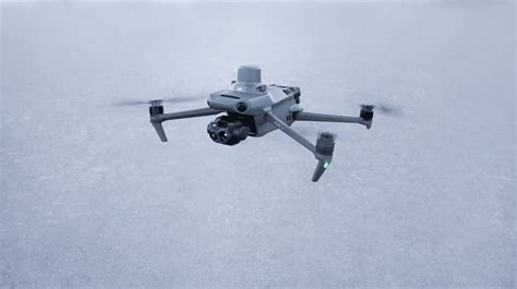
DJI Matrice 30T: The Gold Standard in Search and Rescue Drones
The DJI Matrice 30T has established itself as the go-to drone for professional SAR teams. Combining rugged construction, high-performance sensors, and seamless field deployment, the M30T enables responders to operate in both urban and rural emergency zones under the most demanding conditions.
Equipped with a thermal camera, zoom camera, wide-angle lens, and a laser rangefinder, the M30T delivers multi-source visual intelligence on a single platform. It excels in poor visibility scenarios—be it heavy rain, fog, darkness, or wildfire smoke. Its IP55 rating ensures operational resilience against water and dust ingress, a vital feature in unpredictable environments.
What sets the M30T apart:
- Thermal Imaging: Identify heat signatures of missing persons even through dense canopy or low-light conditions.
- 200x Hybrid Zoom Camera: Spot targets from afar without disturbing ground conditions.
- Laser Rangefinder: Pinpoint exact GPS coordinates for dispatch or recovery teams.
- Flight Time: Up to 41 minutes, critical for covering large perimeters without interruptions.
- Portability: Unlike previous Matrice models, the M30T is compact and deployable from a vehicle trunk.
In field reports from experienced responders, the M30T has replaced older fleets due to its agility, modular sensor payloads, and autonomous flight capabilities.
DJI Mavic 3 Enterprise and Mavic 2 Enterprise Advanced: Budget-Efficient SAR Drones
Not all departments can afford flagship drones like the M30T. For budget-conscious agencies, DJI’s Mavic Enterprise line provides SAR-ready solutions without compromising on critical features. The Mavic 3 Enterprise and Mavic 2 Enterprise Advanced come equipped with thermal and optical zoom capabilities, RTK modules for centimeter-level GPS accuracy, and the compactness necessary for solo field operators.
Their smaller size makes them ideal for backpack deployment, and they are widely used in North American SAR units that operate in mountainous or forested terrain. Despite their lightweight design, these drones maintain wind resistance and stable imaging at high altitudes.
Agencies have found the Mavic line particularly effective in:
- Missing hiker searches across large wilderness areas
- Post-disaster reconnaissance where infrastructure is down
- Quick-deploy overwatch during ongoing operations
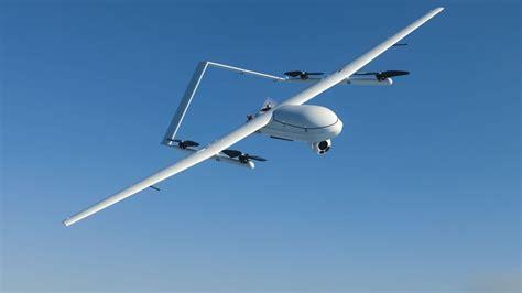
Custom FPV Drones for Cave and Subterranean Missions
In extreme cases where traditional drones cannot function—such as in caves, mines, or collapsed structures—custom-built FPV (first-person view) drones have stepped in. These are manually piloted systems designed for precision control in confined, GPS-denied environments. Teams operating in regions with complex cave systems have reported the use of tethered FPV drones to maintain signal integrity while navigating narrow passages.
The tether, besides preventing signal loss, provides a continuous power supply, extending operational time significantly. These drones are often outfitted with onboard lights, low-light cameras, and protective frames to withstand wall collisions in zero-light settings. Despite being highly specialized, their role in locating trapped individuals underground makes them indispensable in specific mission profiles.
Lidar Mapping and Data Integration with Matrice 300 RTK
For large-scale SAR operations where mapping terrain and predictive modeling are essential, the DJI Matrice 300 RTK equipped with Lidar is a field-proven asset. While slightly older than the M30T, the 300 RTK remains in use due to its ability to gather high-fidelity 3D terrain data in real time. This data is fed into GIS systems and SAR modeling software to predict movement patterns and identify high-probability zones for ground teams.
One Canadian SAR unit has implemented this system to deliver centimeter-level terrain models, allowing real-time deployment adjustments and reducing redundant ground sweeps. This kind of data-driven SAR coordination represents the future of rescue logistics.
Operational Challenges and Considerations
While drone technology has revolutionized SAR, operational deployment requires addressing several challenges:
- Signal Interference: Urban environments and subterranean operations require special configurations or tethering.
- Regulatory Restrictions: Some regions face uncertainty regarding DJI drone bans, leading teams to delay acquisitions.
- Battery Limitations: High-drain sensors and cold weather reduce flight time. Backup batteries and charging protocols are essential.
- Training Requirements: Pilots need FAA Part 107 certifications and specialized SAR training for thermal interpretation and manual flight in challenging conditions.
Funding Sources for SAR Drone Programs
Drones are a significant investment, especially for underfunded or volunteer-led SAR teams. While larger agencies may include them in public safety budgets, others rely on grants and private donations.
One known source is the Rocky Talkie SAR Grant, run through the American Alpine Club, which specifically supports volunteer rescue groups that lack government backing. Many teams also build community relationships to encourage local business sponsorships or engage in crowdfunding campaigns for mission-critical tech.
Public-private partnerships, such as donations from outdoor equipment retailers or outdoor sports brands, have also enabled drone acquisitions alongside related SAR gear like UTVs, rope systems, and communications equipment.
Future Outlook and Emerging Technologies in SAR Drones
The trajectory of SAR drone development is unmistakably moving toward AI-enhanced mission support. We are witnessing the emergence of real-time image analysis software that can flag heat signatures autonomously, as well as machine learning models trained on terrain data to prioritize search areas.
Furthermore, modular drones that allow mid-mission payload swaps—thermal, Lidar, chemical sensors, life sign detectors—are on the horizon. Advanced swarm systems may soon permit multi-drone synchronized sweeps of massive regions, reducing time and maximizing human resource allocation.
However, geopolitical issues affecting supply chains—particularly around DJI’s role in the U.S. market—may influence fleet choices in the coming years. Until reliable alternatives arise domestically, many teams continue relying on DJI’s proven track record while preparing contingency plans.
Conclusion: Precision, Speed, and Reliability Define the Best SAR Drones
In evaluating the best search and rescue drone, the DJI Matrice 30T holds the crown for sheer versatility, sensor quality, and operational resilience. For teams needing affordability and portability, the Mavic 3 Enterprise and Mavic 2 Advanced are worthy workhorses. For niche use cases like underground rescues, custom FPV drones provide irreplaceable capabilities.
As SAR missions grow in complexity and urgency, drone technology stands as a force multiplier, augmenting human effort with real-time intelligence and environmental mastery. For agencies investing in the future of emergency response, the right drone can quite literally make the difference between life and death.


